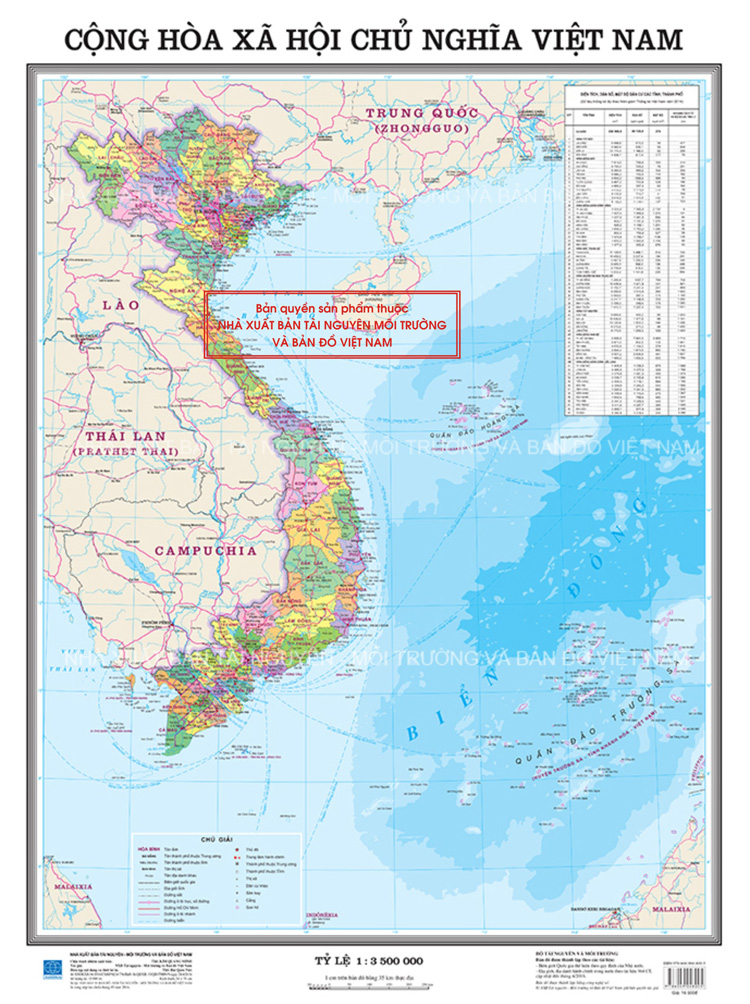
Classification of Administrative Maps at All Levels According to Circular 47
This is one of the important contents stipulated in Circular 47/2014/TT-BTNMT on Technical Regulations for the Establishment of Administrative Maps at All Levels, promulgated on August 22, 2014.

According to Article 4 of Circular 47/2014/TT-BTNMT, the classification of administrative maps by levels is as follows:
- The national administrative map is an administrative map that shows the division and administrative management of provinces within the territory of Vietnam, including mainland, sea, islands, and archipelagos.
- Provincial-level administrative map (province, centrally-run city) (hereinafter referred to as provincial-level administrative map) is an administrative map that shows the division and administrative management of districts, communes within the territory of a province, or a centrally-run city.
- District-level administrative map (district, town, district-level town, provincial city) (hereinafter referred to as district-level administrative map) is an administrative map that shows the division and administrative management of communes within the territory of a district, district-level town, or provincial city.
- The national administrative atlas is a collection of provincial-level administrative maps within the territory of Vietnam with the same dimensions.
- Provincial-level administrative atlas is a collection of district-level administrative maps within the administrative unit of a province with the same dimensions.
- District-level administrative atlas is a collection of commune, ward, commune-level town maps within the administrative unit of a district with the same dimensions.
State administrative maps include the national administrative map with a scale from 1:3,500,000 or larger; provincial-level administrative maps, district-level administrative maps, administrative maps of various levels in atlases with scales that determine the territorial area fitting within the dimensions of paper size from A3 or larger.
More details can be found in Circular 47/2014/TT-BTNMT, which took effect from August 22, 2014.
Thuy Tram
- New regulations on the procedures for veterinary sanitation inspection in Vietnam from January 6, 2025
- Contents of economic - technical norms for the service of collecting and promoting the value of ancient documents in Vietnam from January 05, 2025
- General provisions on economic - technical norms for the service of collecting and promoting the value of ancient documents in Vietnam from January 5, 2025
- Guidelines on the application of service prices for hospital bed days between social insurance agencies and medical examination and treatment facilities in Vietnam from January 1, 2025
- Guidelines for resolving the recording and filming of traffic police officers on duty in Vietnam from the year 2025
- Requirements and standards for traffic police conducting command and traffic control duties in Vietnam from January 1, 2025
-

- New regulations on the procedures for veterinary ...
- 08:00, 23/11/2024
-

- Notable new policies of Vietnam effective from ...
- 17:30, 22/11/2024
-

- Regulations on passing the theoretical knowledge ...
- 15:15, 22/11/2024
-

- Approval of the Scheme for connecting, authenticating ...
- 11:48, 22/11/2024
-

- Program for the prevention and control of child ...
- 11:29, 22/11/2024
 Article table of contents
