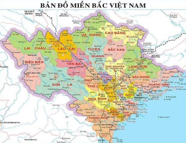
Criteria and content of the National administrative map in Vietnam
Recently, the Ministry of Natural Resources and Environment of Vietnam promulgated Circular 47/2014/TT-BTNMT stipulating the technical regulations for establishing administrative maps at various levels, which includes provisions on the content criteria for national state administrative maps.

Criteria and content of the National administrative map in Vietnam (Illustrative image)
Article 26 of Circular 47/2014/TT-BTNMT stipulates the contents of the national administrative map in Vietnam, including the following elements:
-
Mathematical base elements as specified in Clause 1 Article 21 of Circular 47/2014/TT-BTNMT.
-
National borders and administrative boundaries
-
Hydrographic elements to be depictedThe shoreline is depicted up to the inner frame of the map; the map scale dictates the generalization to maintain the distinctive characteristics of each type of shoreline and major estuaries;All islands and archipelagos of Vietnam are shown according to the following criteria: islands with an area ≥ 0.5 mm² on the map are depicted to scale; islands with an area < 0.5 mm² on the map are shown by non-scale symbols and are selected to ensure shape, direction, and density; islands related to national borders and administrative boundaries are given priority; distinguish between coral islands and other islands; rocks, submerged reefs, tidal flats, others at sea as required by competent state authorities;Depict basic characteristics of river systems; rivers, streams, and canals with a length ≥ 2 cm on the map; depending on the geographical characteristics of each area, this criterion may increase or decrease to 1 cm; show rivers, streams, and canals related to national borders and administrative boundaries;
...
-
Topographic elements to be depictedOn the national administrative map, contour lines are not shown; depict depth contours and depth layers as follows: 200 m, 1500 m, 4000 m; annotate depth points with a density of 4 points/1dm² on the map;Depict special topographic areas: Swamps, large sandy beaches more than 1cm² on the map; distinguish between dry and wet sandy beaches;Depict the locations of the highest and most distinctive peaks nationwide, peaks named on the national border, and administrative boundaries; annotate the height and name of the peak;The national administrative map at a scale of 1:3,500,000 may not depict topographic elements as specified in Points a, b, c Clause 4 of this Article.
-
Population elementsSelectively depict population points. Show population points with non-scale symbols, classified by population;Fully depict district-level towns, cities; commune-level towns are selectively depicted based on the map's capacity;Selectively show rural population points. Prioritize larger population points, famous place names, or directional points while ensuring distribution density;Annotate the names of all selected and classified population points as follows: capital, centrally governed city; city under provincial control; district-level town; commune-level town; rural population points;Distinguish population points that are provincial, district administrative centers.
-
Socio-economic elementsSelectively depict nationally ranked historical and cultural relics and scenic spots. Selectively depict other typical nationwide socio-economic objects.
-
Transportation and related objectsShow railways, roads, maritime routes, and related objects; the level of detail must be suitable for the map scale and ensure the characteristics and system of the transportation network;Show all national railways in use; depict major stations and annotate station names if possible;Classify roads by management levels: National highways, provincial roads, district roads, others;
...
-
Place names on the map
-
Table of area, population, and population density of provinces and citiesShow the names of centrally governed provinces and cities along with the latest published data from competent state authorities;Accompanying data includes: Natural area in km², population in people, population density in people/km²;
-
Other elementsThe map title must be the full name of the country: Socialist Republic of Vietnam;The legend must fully explain the symbols on the map; contents are arranged in the following order: specialized elements, basic geographic elements, other elements;Other information: Fully and accurately annotate the name of the managing authority; name of the mapping unit; name and origin of the mapping document; name of the publisher and responsible person; name of the printing unit; publishing license information; copyright; year of publication.
-
Contents beyond the territory of VietnamSpecialized elements beyond the territory of Vietnam show only the national border and annotate the country name;Basic geographic elements are depicted similarly to the criteria in Clauses 1, 2, 3, 4, 5, 6, 7, and 8 of Article 26, allowing for a 30% reduction in content criteria according to map generalization principles.
More details can be found in Circular 47/2014/TT-BTNMT, effective from August 22, 2014.
Thuy Tram
- Key word:
- administrative map
- Vietnam
- General Department of Taxation for large enterprises in Vietnam introduces certain new points of Circular 86/2024 on taxpayer registration
- 04 cases in which the electricity seller is permitted to suspend electricity supply when the organization violates legal regulations in Vietnam
- Organizational structure of the Supreme People's Procuracy in Vietnam from February 7, 2025
- Vietnam: Regulations on the Dossier requesting approval for the policy to buy and sell electricity with foreign countries from February 01, 2025
- Guidelines on the promotion of judges of People's courts in Vietnam according to Resolution 67/2025/UBTVQH15
- Conditions for level 1, level 2, level 3 judges of the People's Court in Vietnam
-

- General Department of Taxation for large enterprises ...
- 15:26, 15/02/2025
-

- Regulations on statistical classification by economic ...
- 15:04, 15/02/2025
-

- 04 cases in which the electricity seller is permitted ...
- 15:00, 15/02/2025
-

- General requirements in electricity trading with ...
- 14:56, 15/02/2025
-

- Organizational structure of the Supreme People ...
- 14:00, 15/02/2025
-

- Notable documents of Vietnam in the previous week ...
- 15:58, 17/02/2025
-

- General Department of Taxation for large enterprises ...
- 15:26, 15/02/2025
-

- Regulations on statistical classification by economic ...
- 15:04, 15/02/2025
-

- 04 cases in which the electricity seller is permitted ...
- 15:00, 15/02/2025
-

- General requirements in electricity trading with ...
- 14:56, 15/02/2025
 Article table of contents
