What is remote sensing activities? What are the principles of remote sensing activities in Vietnam? - Vu Ngoc (Binh Dinh, Vietnam)
 Article table of contents
What is remote sensing activities? 05 Principles of remote sensing activities in Vietnam (Internet image)
1. What are remote sensing activities?
According to Clause 3, Article 3 of Decree 03/2019/ND-CP, remote sensing activities means those activities relating to the remote sensing image data acquisition system; the acquisition, storage, processing, provision, exploitation and use of remote sensing image data; the building of the remote sensing image database.
2. 05 Principles of remote sensing activities in Vietnam
Specifically, in Article 5 of Decree 03/2019/ND-CP, the principles in remote sensing activities are as follows:
(1) Remote sensing image data, superdata and products must be updated regularly, must be provided sufficiently, accurately and punctually to meet the requirements of socio-economic development, observation and monitoring of natural resources, environment, rescue, salvation, prevention and control of natural disasters, national defence and security.
(2) Remote sensing image data collection infrastructure which is built by using the state budget funds shall be deemed as public assets, inherited, commonly used, managed and protected as per laws.
(3) National remote sensing database must be maintained, operated and updated frequently in order to build and update the national geographic database, the topographic map and the national geospatial data, and must comply with laws on cybersecurity.
(4) The central government’s budget shall provide ministries, ministry-level agencies and Governmental bodies with funds for exercise of the regulatory authority over remote sensing activities; building and operation of remote sensing data acquisition systems; acquisition, storage, processing, provision, exploitation and usage of remote sensing image data; building of remote sensing image databases.
(5) The local government’s budget shall provide People's Committees of all levels with funds for exercise of the regulatory authority over remote sensing activities; acquisition, storage, processing, provision, exploitation and usage of remote sensing image data; building of remote sensing image data within their jurisdiction.
3. Applications of remote sensing image data in Vietnam
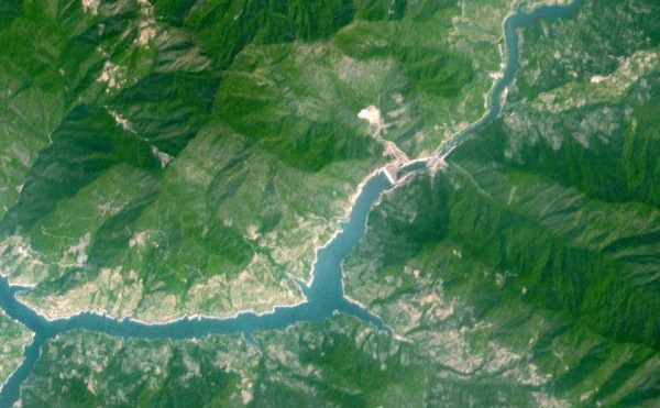
Remote sensing image data means geographic object information and images obtained from remote sensing satellites. (Clause 2, Article 3 of Decree 03/2019/ND-CP)
Specifically, the remote sensing image data shall be exploited and used in the following activities:
- Monitoring and observing environmental pollution, including soil and water pollution caused by domestic and industrial waste; air pollution caused by industrial and domestic gas emissions; environmental pollution caused by natural disasters, the spreading of hazardous minerals and mining activities; making statistical reports on greenhouse gas emissions.
- Collecting information and data, analyzing, investigating, assessing and monitoring changes in natural resources and environment on a regular and irregular basis in order to produce reports used for performing the socio-economic development tasks; preventing and controlling natural disasters;
Monitoring drought, alerting bush fire, reporting on flood, rescue and salvation and responding to climate change; assessing current conditions of agricultural production.
- Building and updating specialized maps and databases on current conditions of natural resources and environment, the reality of climate change; drawing geologic maps on different scales.
- Updating the national geographical database and the national topographic map system.
- Supporting national defence and security tasks.
(Article 6 of Decree 03/2019/ND-CP)
4. Acquisition of remote sensing image data in Vietnam
According to Clause 1, Article 15 of Decree 03/2019/ND-CP, the remote sensing image data may be collected from the following sources:
- Remote sensing data acquisition stations of Vietnam;
- Purchased, bartered data or data received as foreign aid.
Thanh Rin
- Key word:
- remote sensing activities in Vietnam