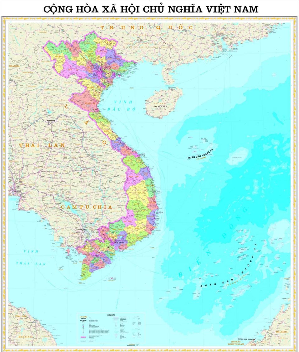
Hydrological factors in the content criteria of provincial and district administrative maps in Vietnam
Recently, the Ministry of Natural Resources and Environment of Vietnam issued Circular 47/2014/TT-BTNMT which stipulates the technical regulations on the establishment of administrative maps at all levels. The circular includes provisions on the content criteria for provincial and district-level administrative maps.

Hydrological factors in the content criteria of provincial and district administrative maps in Vietnam (Illustrated example)
Clause 3, Article 27 of Circular 47/2014/TT-BTNMT stipulates the hydrological elements in the content criteria of provincial and district administrative maps in Vietnam as follows:
- The coastline is depicted to the inner frame of the map; depending on the map scale, generalization must ensure retention of the characteristic features of each type of coastline and major river estuaries;
- Depict Vietnamese islands according to the following criteria: Depict all islands with an area ≥ 0.5 mm² on the scale map; islands with an area <0.5 mm² on the map can be depicted with non-scale representation and can be selectively shown but must ensure shape, orientation, and distribution density; islands related to national border factors and administrative boundaries are prioritized for selection; distinguish coral islands, other islands, rocks, shoals, reefs, other areas on the sea as per the requirements of the competent state authority;
- Depict the basic characteristics of river systems; rivers, streams, canals with a length ≥ 5 cm on the map; depending on the geographical characteristics of each area, this criterion can be increased or decreased by 2 cm. Prioritize depicting rivers, streams, canals related to national borders and administrative boundaries;
- Rivers, streams, canals with a width ≥ 0.7 mm on the map are depicted to scale; narrower rivers, streams are depicted with a single line with the line thickness gradually reducing towards the upstream. Selectively depict rivers, streams, canals with single lines ensuring density and distribution shape;
- Depict lakes with an area ≥ 10 mm² on the map; lakes <10 mm² that are related to national border factors, administrative boundaries, or water-scarce areas;
- Depict islets and sandbanks on rivers with an area on the map ≥ 2 mm²; islets and sandbanks <10 mm² and ≥ 0.5 mm² that are related to national border factors, administrative boundaries;
- Note hydrological place names as follows:
- Names of seas, bays, gulfs, straits, major river mouths; names of rivers with a length ≥ 7 cm on the map; lakes with an area ≥ 25 mm² on the map;- Names of major islands and all archipelagos; must annotate with the names of the managing district, provincial administrative unit, and the name of the country "Vietnam" according to the competent state authority's requirements.
Priority is given to notes for geographical objects related to national borders and administrative boundaries.
More details can be found in Circular 47/2014/TT-BTNMT, effective from August 22, 2014.
Thuy Tram
- Key word:
- Hydrological factor
- administrative map
- Vietnam
- General Department of Taxation for large enterprises in Vietnam introduces certain new points of Circular 86/2024 on taxpayer registration
- 04 cases in which the electricity seller is permitted to suspend electricity supply when the organization violates legal regulations in Vietnam
- Organizational structure of the Supreme People's Procuracy in Vietnam from February 7, 2025
- Vietnam: Regulations on the Dossier requesting approval for the policy to buy and sell electricity with foreign countries from February 01, 2025
- Guidelines on the promotion of judges of People's courts in Vietnam according to Resolution 67/2025/UBTVQH15
- Conditions for level 1, level 2, level 3 judges of the People's Court in Vietnam
-

- General Department of Taxation for large enterprises ...
- 15:26, 15/02/2025
-

- Regulations on statistical classification by economic ...
- 15:04, 15/02/2025
-

- 04 cases in which the electricity seller is permitted ...
- 15:00, 15/02/2025
-

- General requirements in electricity trading with ...
- 14:56, 15/02/2025
-

- Organizational structure of the Supreme People ...
- 14:00, 15/02/2025
-

- Notable documents of Vietnam in the previous week ...
- 15:58, 17/02/2025
-

- General Department of Taxation for large enterprises ...
- 15:26, 15/02/2025
-

- Regulations on statistical classification by economic ...
- 15:04, 15/02/2025
-

- 04 cases in which the electricity seller is permitted ...
- 15:00, 15/02/2025
-

- General requirements in electricity trading with ...
- 14:56, 15/02/2025
 Article table of contents
