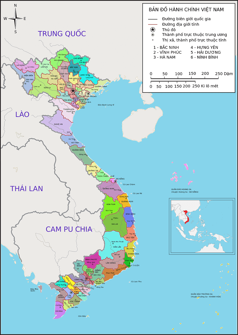
Vietnam: Determination of the layout of the state administrative map according to Circular 47
Recently, the Ministry of Natural Resources and Environment of Vietnam promulgated Circular 47/2014/TT-BTNMT on technical regulations on administrative maps of all levels, including the provisions on the method for determining the layout of state administrative maps.

Vietnam: Determination of the layout of the state administrative map according to Circular 47 (Illustrative Image)
The layout of the state administrative map in Vietnam is determined as follows:
1. Nationwide governmental administrative map
- Maps must be able to fully convey Vietnamese territory including mainland, islands, archipelagos; especially all islands and archipelagoes in their entirety according to regulations of competent authority;
- Frame line is rectangular and displayed as shown under Appendix 1 attached hereto;
- Maps must show Vietnamese territory from 102o - 118o meridian East; 04o 30’ - 23o 30’ parallel North;
- Map name must be the full name: Cộng hòa xã hội chủ nghĩa Việt Nam (Socialist Republic of Vienam) and displayed above the north frame line;
- Map scale and scale indicator; name of presiding authority; name of entity creating the map; name and origin of component documents; name of publisher and publishing director; name of printing entity; information of publishing permit; copyright; publishing year must be displayed below the south frame line;
- Legend is located outside of Vietnamese territory illustration;
- Depending on use purpose, legends containing area, population, population density of provinces and central-affiliated cities and secondary map can be positioned outside of Vietnamese territory illustration;
- Other information is reasonably positioned below the south frame line of the map.
2. Provincial-level, district-level governmental administrative maps
- The maps must convey the respective administrative division in the center in its entirety; administrative divisions of the same level of adjacent countries excluding geographical features; shoreline where applicable;
- Frame line is rectangular and displayed as shown under Appendices 5a and 5b attached hereto;
- Map name must be the full name of provincial-level, district-level administrative division and located above or below the north frame line;
- Maps are divided into grids which are numbered with natural number from north to south, east to west;
- Map scale and distance scaling; name of presiding authority; name of entity creating the map; name and origin of component documents; name of publisher and publishing director; name of printing entity; information of publishing permit; copyright; publishing year must be displayed below the south frame line;
- Legend; secondary maps; legend containing area, population of provinces and district-level cities or legend containing area, population of district or secondary map are positioned outside of the main territory illustration;
- Other information is positioned outside and below south frame line.
When creating the state administrative map, individuals tasked with determining the layout of the administrative map shall apply this regulation consistently.
More details can be found in Circular 47/2014/TT-BTNMT effective from August 22, 2014.
Thuy Tram
- General Department of Taxation for large enterprises in Vietnam introduces certain new points of Circular 86/2024 on taxpayer registration
- 04 cases in which the electricity seller is permitted to suspend electricity supply when the organization violates legal regulations in Vietnam
- Organizational structure of the Supreme People's Procuracy in Vietnam from February 7, 2025
- Vietnam: Regulations on the Dossier requesting approval for the policy to buy and sell electricity with foreign countries from February 01, 2025
- Guidelines on the promotion of judges of People's courts in Vietnam according to Resolution 67/2025/UBTVQH15
- Conditions for level 1, level 2, level 3 judges of the People's Court in Vietnam
-

- General Department of Taxation for large enterprises ...
- 15:26, 15/02/2025
-

- Regulations on statistical classification by economic ...
- 15:04, 15/02/2025
-

- 04 cases in which the electricity seller is permitted ...
- 15:00, 15/02/2025
-

- General requirements in electricity trading with ...
- 14:56, 15/02/2025
-

- Organizational structure of the Supreme People ...
- 14:00, 15/02/2025
-

- Notable documents of Vietnam in the previous week ...
- 15:58, 17/02/2025
-

- General Department of Taxation for large enterprises ...
- 15:26, 15/02/2025
-

- Regulations on statistical classification by economic ...
- 15:04, 15/02/2025
-

- 04 cases in which the electricity seller is permitted ...
- 15:00, 15/02/2025
-

- General requirements in electricity trading with ...
- 14:56, 15/02/2025
 Article table of contents
