Circular 48: Regulations on the Establishment of Administrative Boundary Maps at the District and Provincial Levels
On August 22, 2014, the Ministry of Natural Resources and Environment issued Circular 48/2014/TT-BTNMT specifying the technical standards for determining administrative boundary lines, setting administrative boundary markers, and compiling administrative boundary dossiers at various levels.

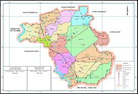
Circular 48: Regulations on the establishment of administrative boundary maps at district and provincial levels (illustrative photo)
Circular 48/2014/TT-BTNMT stipulates the establishment of administrative boundary maps at district and provincial levels as follows:
- District-level administrative boundary maps are established using digital technology from the data source of commune-level administrative boundary maps for printing on paper. Provincial-level administrative boundary maps are established using digital technology from district-level administrative boundary maps.- Administrative boundary markers and characteristic points at district and provincial levels are depicted according to the correct coordinate values in the table of administrative boundary markers and characteristic points on the district and provincial administrative boundaries. In case of conflicts regarding the position of the markers with adjacent geographical factors, it is necessary to re-edit the related geographical elements on the map accordingly.- Administrative boundary factors and geographical elements related to the administrative boundary line from the commune-level administrative boundary map editing results are generalized and depicted on the base map according to the content regulations and representation requirements at corresponding scales. Associated content elements on the base map must be modified and edited appropriately without conflict.- Administrative boundary lines at various levels are shown in district and provincial administrative boundary maps, inheriting the editing results from commune-level administrative boundary maps. In case of conflicts, necessary corrections and edits must be made according to the priority of administrative boundary factors and ensuring completeness as described in the administrative boundary description at the corresponding level.- Editing of district and provincial administrative boundary maps for printing on paper is carried out according to the regulations for editing commune-level administrative boundary maps for printing on paper.
For details, see Circular 48/2014/TT-BTNMT effective from November 3, 2014.
Ty Na
- Assessment of technical conditions for the exploration of rare earth mineral mines in Vietnam from January 06, 2025
- Investigation content on rare earth mineral resources in Vietnam from January 6, 2025
- Standards for traffic police conducting road traffic accident investigations in Vietnam from January 1, 2025
- Regulations on the maximum speed of motor vehicles in Vietnam from January 1, 2025
- Reorganization of commune-level administrative units in Vinh Phuc province from January 01, 2025
- Reorganization of administrative units in Tra Vinh province from January 1, 2025
-

- Implementation of policies for the development ...
- 14:44, 28/11/2024
-
- Procedures for settling financial support for ...
- 14:30, 28/11/2024
-

- Guidelines for developing economic-technical norms ...
- 14:30, 28/11/2024
-

- Standards for expenses in execution of tasks of ...
- 14:12, 28/11/2024
-

- Classification of labor according to working conditions ...
- 14:02, 28/11/2024
 Article table of contents
