Approval of the National hydrometeorological Station Network Planning for the period 2021–2030, with a vision to 2050 in Vietnam
What are the details of the National hydrometeorological Station Network Planning for the period 2021–2030, with a vision to 2050 in Vietnam approved by the Prime Minister of Vietnam? - Minh Nhut (Hoa Binh)

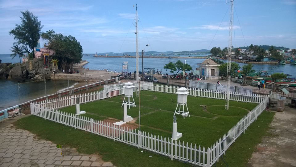
Approval of the National hydrometeorological Station Network Planning for the period 2021–2030, with a vision to 2050 in Vietnam (Internet image)
On April 8, 2024, the Prime Minister of Vietnam issued Decision 289/QD-TTg approving the National hydrometeorological Station Network Planning for the period 2021–2030, with a vision to 2050.
Approval of the National hydrometeorological Station Network Planning for the period 2021–2030, with a vision to 2050 in Vietnam
The Prime Minister approves the National hydrometeorological Station Network Plan for the period 2021–2030, with a vision to 2050, with the following development perspectives and objectives:
(1) Perspectives
- hydrometeorological information and data are important inputs for various sectors and economic and social fields, serving the daily lives of people and playing a significant role in disaster prevention, national defense, and security. Investing in the national hydrometeorological station network is an investment in development that needs to take a proactive approach, ensuring modernity, coherence, and efficient operation.
- The planning is developed based on the perspectives, principles, and guidelines of the Party, the policies and laws of the State, and is aligned with the strategies for socio-economic development, safeguarding the country, ensuring national security, development strategies for the sector, and strategies for disaster prevention. It ensures inheritance, compliance with the hierarchical system of planning, and alignment with the national overall planning.
- The planning must be based on practicality, addressing the existing deficiencies and shortcomings of the current hydrometeorological station network, based on scientific foundations, dynamic and open, with innovative and creative thinking, effectively utilizing scientific and technological achievements, digital transformation, automation, and meeting the requirements of immediate and long-term tasks.
- The planning must be closely linked to the requirements of improving the accuracy, timeliness, and reliability of hydrometeorological forecasting and warning work, monitoring climate change to serve effective socio-economic development, national defense, security, disaster prevention, and climate change adaptation.
- The planning must be oriented towards multi-objective integration, maximizing integration with other national resource and environmental monitoring networks, specialized monitoring systems of relevant sectors, being an open system, the backbone of infrastructure, management, and operation, and ensuring unified management by the Ministry of Natural Resources and Environment.
- The plan is closely associated with the focus on enhancing the quality of human resources to meet the new requirements in the management and operation of the national hydrometeorological station network towards automation, advancement, and modernization.
(2) Development objectives
* General objective: Gradually develop a modern and synchronized national hydrometeorological station network, reaching the same level as developed countries in the Asia region and the world; have the capability to integrate, embed, connect, and share data with the national resource and environmental monitoring network and the global hydrometeorological station network, as well as specialized monitoring systems of various sectors; meet the demand for information and data, enhance the quality of forecasting and timely weather warning, and serve socio-economic development, national defense, security, disaster prevention, and climate change adaptation.
* Specific objectives: Focus on development, upgrading, automation, modernization, and supplementation of monitoring elements; increase the density of stations, especially in areas prone to natural disasters, data-deficient areas, areas highly impacted by climate change, coastal areas, islands, and archipelagos under Vietnam's sovereignty and sovereignty rights; ensure a rational distribution of station networks among regions with heterogeneous meteorological, hydrological, and topographical conditions. Upgrade information infrastructure and databases in a centralized, modern, and synchronized manner; enhance the application of artificial intelligence in management, inspection, monitoring, sharing, and utilization of hydrometeorological monitoring data. Improve legal systems, technical regulations, economic-technical norms, and organizational structures, and rearrange human resources to align with the process of automation and socialization.
- By 2025: The average station density across the entire network will reach the same level as developed countries in the Southeast Asia region (surface meteorology: 1,100 km2/station; independent rainfall measurement: 121 km2/station; radiation: 21,000 km2/station; lightning location: 15,000 km2/station; hydrology: 1,520 km2/station/watershed; oceanography: 112 km/station along the coast, 250 km/station offshore). The automation rate for surface meteorological stations exceeds 40%; for water level monitoring stations, it reaches 50%; for independent rainfall measurement stations, it reaches 100%; and for water flow measurement stations, it reaches 20%.
- By 2030: the average station density across the entire network will reach the same level as developed countries in the Asia region (surface meteorology: 840 km2/station; independent rainfall measurement: 80 km2/station; radiation: 18,000 km2/station; lightning location: 14,000 km2/station; ozone-UV radiation: 82,000 km2/station; hydrology: 650 km2/station/watershed; oceanography: 70 km/station along the coast, 200 km/station offshore, buoy stations: 650 km/station along the coast). The automation rate for meteorological stations, water level monitoring stations, rainfall measurement stations, and upper-air wind measurement stations exceeds 95%, and for water flow measurement stations, it reaches a minimum of 40%. Upgrade and modernize laboratories, calibration systems, and verification systems for hydrometeorological measurement instruments. Modernize the information, data, and digital transformation systems of the hydrometeorological sector. Explore and research new types of monitoring stations, such as meteorological monitoring stations on mobile platforms like reconnaissance aircraft, ships, satellite meteorology and remote sensing, meteorological rockets, unmanned devices, and other modern monitoring technologies and instruments.
- Vision until 2050: The density of automated hydrometeorological stations reaches the same level as developed countries worldwide, with a total of 5,886 stations by 2050. Convert most of the hydrometeorological stations to fully automated ones, following the modern network model of developed countries. Research and pilot new types of monitoring stations, such as meteorological monitoring stations on mobile platforms like reconnaissance aircraft, ships, satellite meteorology and remote sensing, meteorological rockets, unmanned devices, and other modern monitoring technologies and instruments.
More details can be found in Decision 289/QD-TTg, taking effect on April 8, 2024, replacing Decision 90/QD-TTg dated January 12, 2016.
Ho Quoc Tuan
- Duties and powers of the Prime Minister the Government of Vietnam under the latest regulations in 2025
- Guidelines for propaganda on the Hung Kings Commemoration Day in 2025 (March 10 of the lunar calendar) in Vietnam
- System of financial management organization of trade unions in Vietnam according to Decision 1408/QD-TLD
- New regulations on the distribution of financial revenue sources for grassroots trade unions in Vietnam
- Resolution 190: Guidance on citizen reception, complaint and denunciation resolution during organizational restructuring process in Vietnam
- Provisions on naming and use of seals after the organizational restructuring in Vietnam according to Resolution 190
-

- Regulations on the lawmaking and amendment of ...
- 14:01, 22/02/2025
-

- Guidelines for propaganda on the Hung Kings Commemoration ...
- 10:34, 22/02/2025
-

- System of financial management organization of ...
- 10:00, 22/02/2025
-

- New regulations on the distribution of financial ...
- 09:30, 22/02/2025
-

- Resolution 190: Guidance on citizen reception ...
- 09:00, 22/02/2025
-

- Duties and powers of the Prime Minister the Government ...
- 15:00, 22/02/2025
-

- Regulations on the lawmaking and amendment of ...
- 14:01, 22/02/2025
-

- Guidelines for propaganda on the Hung Kings Commemoration ...
- 10:34, 22/02/2025
-

- System of financial management organization of ...
- 10:00, 22/02/2025
-

- New regulations on the distribution of financial ...
- 09:30, 22/02/2025
 Article table of contents
