What is flood alarm level 2? What is the water level on the Red River in Hanoi, Vietnam at 9:00 AM on September 11, 2024?
What is flood alarm level 2?
According to Article 3 Decision 05/2020/QD-TTg stipulating the principles for flood alarming leveling in Vietnam:
Article 3. Principles for flood alarming leveling
Flood alarm levels are the classification of flood severity. Each flood level is determined through a corresponding water level value specified at hydrological stations on rivers and streams, reflecting the severity of the flood and the level of inundation caused by the flood.
Flood alarm levels are divided into three levels based on the characteristics, magnitude of flood water levels, and the impact of floods on the safety of dykes, banks, river beaches, structures, and the socio-economic conditions in the area.
Under the above provisions, flood alarming is divided into three levels: alarm level 1, alarm level 2, and alarm level 3, based on the characteristics, magnitude of flood water levels, and the impact of floods on the safety of dykes, banks, river beaches, structures, and the socio-economic conditions in the area.
Thus, Flood alarm level 2 is the threshold level indicating that the flood in the river has reached a medium level, with floodwaters beginning to cause inundation and negative impacts on the livelihoods, economy, and society - equivalent to an average flood.
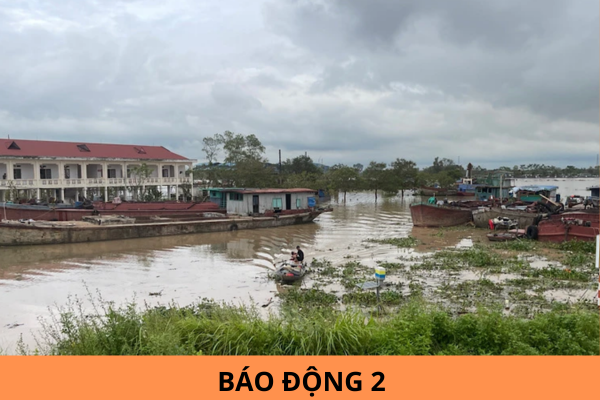
What is flood alarm level 2? What is the water level on the Red River in Hanoi, Vietnam at 9:00 AM on September 11, 2024? (Image from the Internet)
What is the water level on the Red River in Hanoi, Vietnam at 9:00 AM on September 11, 2024?
According to the Emergency Flood Report Download at 9:00 AM from the National Hydrometeorological Forecasting Center, the current flood situation is as follows:
- Floods on the Cau River (Bac Ninh), Thuong River (Bac Giang), Thai Binh River (Hai Duong), and Red River (Hanoi) are rising.
- Floods on the Thao River in Yen Bai are slowly receding; in Phu Tho, it is slowly transforming.
- Floods on the Lo River (Tuyen Quang, Phu Tho) peaked at 27.73m, 1.73m above alarm level 3 at 5:00 AM on September 11 and are slowly receding, while the Hoang Long River (Ninh Binh) remains slowly transforming
- Floods on the Luc Nam River (Bac Giang) are receding. The water levels at 7:00 AM on September 11 on the rivers are as follows:
- On the Thao River in Yen Bai: 34.51m, 2.51m above alarm level 3, 0.09m above the historical flood level of 1968 (34.42m); in Phu Tho: 18.33m, 0.13m above alarm level 2.
- On the Cau River at Dap Cau: 7.20m, 0.90m above alarm level 3.
- On the Thuong River at Phu Lang Thuong: 7.09m, 0.79m above alarm level 3
.- On the Luc Nam River at Luc Nam: 6.04m, 0.26m below alarm level 3.
- On the Lo River at Tuyen Quang: 27.72m, 1.72m above alarm level 3; at Vu Quang: 21.01m, 0.51m above alarm level 3.
- On the Hoang Long River at Ben De: 4.47m, 0.47m above alarm level 3.
- On the Thai Binh River at Pha Lai: 5.83m, 0.17m below alarm level 3.
- On the Red River in Hanoi: 10.86m, 0.36m above alarm level 2.
Thus, the water level on the Red River in Hanoi at 9:00 AM on September 11, 2024, was 10.86m, 0.36m above alarm level 2.
What are the regulations on production of bulletins for forecasting and warning tropical depressions, large waves, and water surges due to tropical depressions in Vietnam?
According to Article 8 Decision 05/2020/QD-TTg stipulating the production of bulletins for forecasting and warning tropical depressions, large waves, and water surges due to tropical depressions in Vietnam:
[1] Bulletin for tropical depressions near the East Sea
A bulletin for tropical depressions near the East Sea is issued when a tropical depression is active outside the East Sea and is likely to move into the East Sea within the next 24 to 48 hours.
[2] Bulletin for tropical depressions in the East Sea
A bulletin for tropical depressions in the East Sea is issued when a tropical depression is active in the East Sea and has not yet shown the possibility of directly affecting the mainland of Vietnam within the next 24 hours.
[3] Emergency bulletin for tropical depressions
An emergency bulletin for tropical depressions is issued when a tropical depression is likely to directly affect the mainland of Vietnam within the next 24 hours.
[4] Bulletin for tropical depressions on the mainland
A bulletin for tropical depressions on the mainland is issued when one of the following conditions occurs:- The center of the tropical depression has moved onto the mainland of Vietnam and the strongest winds are still at level 6 or above.- The center of the tropical depression has moved into neighboring countries, but the strongest winds are still at level 6 or above and are likely to directly affect Vietnam within the next 24 hours.
[5] Quick bulletin on tropical depressions
A quick bulletin on tropical depressions is issued when releasing an emergency tropical depression bulletin or in cases where the tropical depression evolves complexly.
[6] Final bulletin on tropical depressions
The final bulletin on tropical depressions is issued when one of the following conditions occurs:- The tropical depression has weakened into a low-pressure area.- The tropical depression has made landfall in neighboring countries or has moved out of the territory, no longer capable of directly affecting Vietnam.- The tropical depression has moved out of the East Sea and has no possibility of returning to the East Sea.
[7] Bulletin on large waves and water surges due to tropical depressions
A bulletin for forecasting and warning of large waves and water surges due to tropical depressions is issued immediately when releasing an emergency tropical depression bulletin.
