List of preferred remote sensing science and technology activities in Vietnam

What does the list of preferred remote sensing science and technology activities in Vietnam include? - My Hien (Can Tho)
 Article table of contents
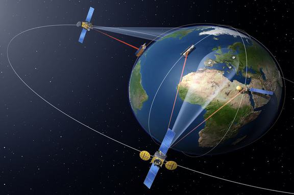
List of preferred remote sensing science and technology activities in Vietnam (Internet image)
Regarding this issue, LawNet would like to answer as follows:
1. List of preferred remote sensing science and technology activities
List of preferred remote sensing science and technology activities according to Article 5 of Decree 03/2019/ND-CP is as follows:
- Conduct researches on scientific bases for improvement of remote sensing law and institution.
- Research , apply and transfer high, advanced and innovative remote sensing technologies intended for basic surveys, management, monitoring and surveillance of mining and usage of natural resources and environmental protection, prevention, control and mitigation of consequences of natural disasters, response to climate change, rescue, salvation and remediation of environmental accidents and emergencies; take control of and manage territory, national defence, security, and give direction and administration over agricultural production activities; conduct basic earth researches.
2. Principles of remote sensing activities in Vietnam
Principles of remote sensing activities in Vietnam according to Article 4 of Decree 03/2019/ND-CP are as follows:
- Remote sensing image data, superdata and products must be updated regularly, must be provided sufficiently, accurately and punctually to meet the requirements of socio-economic development, observation and monitoring of natural resources, environment, rescue, salvation, prevention and control of natural disasters, national defence and security.
- Remote sensing image data collection infrastructure which is built by using the state budget funds shall be deemed as public assets, inherited, commonly used, managed and protected as per laws.
- National remote sensing database must be maintained, operated and updated frequently in order to build and update the national geographic database, the topographic map and the national geospatial data, and must comply with laws on cybersecurity.
- The central government’s budget shall provide ministries, ministry-level agencies and Governmental bodies with funds for exercise of the regulatory authority over remote sensing activities; building and operation of remote sensing data acquisition systems; acquisition, storage, processing, provision, exploitation and usage of remote sensing image data; building of remote sensing image databases.
- The local government’s budget shall provide People's Committees of all levels with funds for exercise of the regulatory authority over remote sensing activities; acquisition, storage, processing, provision, exploitation and usage of remote sensing image data; building of remote sensing image data within their jurisdiction.
3. Applications of remote sensing image data in Vietnam
According to Article 6 of Decree 03/2019/ND-CP, remote sensing image data shall be exploited and used in the following activities:
- Monitoring and observing environmental pollution, including soil and water pollution caused by domestic and industrial waste; air pollution caused by industrial and domestic gas emissions; environmental pollution caused by natural disasters, the spreading of hazardous minerals and mining activities; making statistical reports on greenhouse gas emissions.
- Collecting information and data, analyzing, investigating, assessing and monitoring changes in natural resources and environment on a regular and irregular basis in order to produce reports used for performing the socio-economic development tasks; preventing and controlling natural disasters; monitoring drought, alerting bush fire, reporting on flood, rescue and salvation and responding to climate change; assessing current conditions of agricultural production.
- Building and updating specialized maps and databases on current conditions of natural resources and environment, the reality of climate change; drawing geologic maps on different scales.
- Updating the national geographical database and the national topographic map system.
- Supporting national defence and security tasks.
- Key word:
- science and technology activities
- in Vietnam
- Cases of registration of security interests in movable property falling under the authority of Center for Registration of Transactions and Assets in Vietnam
- Procedures for provision of land-related information or data in Vietnam
- Regulations on the Effectiveness of the Latest Land Recovery Notification
- Guidance on Extending the Deadline for Paying Special Consumption Tax on Locally Produced or Assembled Automobiles
- Prohibited acts of accreditors of higher education and pedagogical colleges in Vietnam
- Criteria for assessment of construction of safe schools for prevention and control of accidents and injuries

-

- Cases of registration of security interests in ...
- 13:00, 01/09/2024
-
- 08 Rights of Social insurance beneficiaries in ...
- 12:00, 01/09/2024
-

- Development of human resources to advise on law ...
- 11:30, 31/08/2024
-
- National marine spatial planning in Vietnam for ...
- 09:29, 31/08/2024
-
- Newest guidelines for issuance of Certificate ...
- 18:00, 30/08/2024
-

- Cases of registration of security interests in ...
- 13:00, 01/09/2024
-

- 08 Rights of Social insurance beneficiaries in ...
- 12:00, 01/09/2024
-
- Procedures for provision of land-related information ...
- 11:01, 01/09/2024
-

- Ministry of Health's response to the petition ...
- 10:00, 01/09/2024
-

- Regulations on Study Time for Primary School Students ...
- 09:00, 01/09/2024
