Regulations on the Content of Administrative Boundary Maps at All Levels
Recently, the Ministry of Natural Resources and Environment issued Circular 48/2014/TT-BTNMT regulating techniques for determining administrative boundaries, placing boundary markers, and establishing administrative boundary records at various levels.

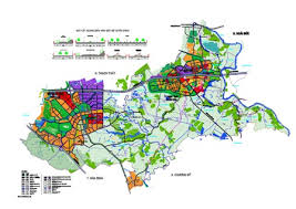
Regulations on the content of administrative boundary maps at all levels (Illustrative image)
Circular 48/2014/TT-BTNMT stipulates the content of administrative boundary maps at all levels. To be specific, it includes the following contents:
- Content elements of the base map;- Administrative boundary elements: administrative boundary lines, boundary markers and characteristic points on the administrative boundary line. In cases where the administrative boundary line is in dispute, the map must show the administrative boundary line as it is currently managed according to the perspective of each adjacent administrative unit and indicate the undefined boundary line;- Geographic elements related to the administrative boundary line that are used as orientation aids to determine the position and describe the boundary line;- Place names of administrative units within the map section; names of residential areas, hydrology, topography within the administrative unit and within 2cm of the boundary line at the time of map creation. All place names on the administrative boundary map within the administrative unit must be listed on a statistical form for residential names, topographic names, hydrological names according to the template provided in Appendix 10 issued with this Circular;- Islands, rocks, shoals, and reefs must be annotated with the managing administrative unit in parentheses beneath or beside the island's name. In cases where islands, rocks, shoals, and reefs are far from the mainland (outside the map sheet's mainland area), an explanatory diagram must be provided;- For administrative units that have national borders, the administrative boundary lines must be represented up to the national border.
Detailed information is available at Circular 48/2014/TT-BTNMT, effective from November 3, 2014.
Ty Na
- Assessment of technical conditions for the exploration of rare earth mineral mines in Vietnam from January 06, 2025
- Investigation content on rare earth mineral resources in Vietnam from January 6, 2025
- Standards for traffic police conducting road traffic accident investigations in Vietnam from January 1, 2025
- Regulations on the maximum speed of motor vehicles in Vietnam from January 1, 2025
- Reorganization of commune-level administrative units in Vinh Phuc province from January 01, 2025
- Reorganization of administrative units in Tra Vinh province from January 1, 2025
-

- Promulgation of new Decree guiding the Law on ...
- 10:34, 28/11/2024
-

- Assessment of technical conditions for the exploration ...
- 10:00, 28/11/2024
-

- Investigation content on rare earth mineral resources ...
- 09:30, 28/11/2024
-

- Standards for traffic police conducting road traffic ...
- 09:00, 28/11/2024
-

- Regulations on the maximum speed of motor vehicles ...
- 08:30, 28/11/2024
 Article table of contents
