Hanoi-Vietnam: Technological labor norm in spectrum measurement/sampling under Circular 08
On July 05, 2019, the Vietnam Ministry of Natural Resources and Environment issued Circular No. 08/2019/TT-BTNM regarding the Economic-technical norms for the design of thematic maps by using remote sensing images in Vietnam at scales of 1:5,000, 1:10,000, 1:500,000, 1:1,000,000.

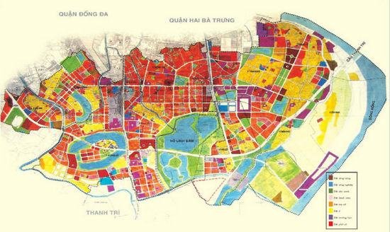
Vietnam: Technological labor norm in spectrum measurement/sampling under Circular 08 (Illustrative Image)
Economic-technical norms issued with Circular 08/2019/TT-BTNMT provide detailed regulations on technological labor norm in spectrum measurement/sampling applicable exclusively for the design of thematic maps at scales of 1:5,000, and 1:10,000 in Vietnam. To be specific:
Task Content:
- Preparing the Plan
+ Collecting remote sensing photography materials, maps, statistical data, information on geographic location characteristics, socio-economic conditions, photography dates, and weather conditions for the spectrum measurement area.
+ Analyzing the collected information to select the date, transportation means, and number of participants for spectrum measurement.
- Designing a position diagram for expected spectrum measurement/sampling points in the field
+ Based on the approved technical design requirements, selecting and identifying the expected points to be conducted in the field on remote sensing maps or maps.
+ Creating directional guides to the practically identified expected positions.
- Conducting spectrum measurement/sampling in the field
+ Accurately identifying the position of spectrum measurement/sampling points in the field and orienting.
+ Correcting precise positions on remote sensing maps or maps, noting measurement points.
+ Testing the spectrometer and auxiliary equipment (computer, GPS measuring device...).
+ Taking spectrum samples/Measurements (at each measuring point at least three times), performing rough calculations and checks, contacting related groups, and moving.
- Calculating results of field spectrum measurement/sampling
+ Transferring spectrum measurement/sampling data.
+ Using specialized software to calculate results.
+ Checking accuracy.
+ Exporting spectrum measurement data to Excel.
- Resampling
+ Arranging field spectrum measurement values by remote sensing channel on an Excel file.
+ Calculating and editing data to bring the field object's reflectance spectrum values to the same spectrum resolution as the remote sensing images.
- Checking, comparing spectrum values
+ Drawing reflectance spectrum curves.
+ Comparing the spectrum curves of objects at different measuring points, combining knowledge of the object's reflectance spectrum characteristics to eliminate the possibility of confusion.
- Classifying spectrum samples
+ Building spectrum libraries according to the usage purpose.
+ Classifying, and grouping spectrum samples into groups of objects as arranged in the spectrum library.
- Making a report on spectrum measurement/sampling results
Difficulty classification:
- Type 1: Plain areas, few trees, sparsely populated. Bare, low hill areas (average height below 50m), midland regions, convenient transportation, cars can reach points within 1 km. Convenient point selection and measurement
- Type 2: Plain areas with many trees, densely populated areas. Sparse tree hill areas in midland regions, relatively convenient transportation, cars can reach points 1 to 3 km away. Relatively convenient point selection and measurement
- Type 3: Mountainous areas from 50 to 200m high. Inconvenient transportation, cars can reach points 3 to 5 km away. Inconvenient point selection and measurement.
- Type 4: Mountainous areas from 200 to 800m high. Marshy, deep areas. Difficult transportation, cars can reach points 5 to 8 km away. Difficult point selection and measurement.
- Type 5: Island, border, and mountainous areas over 800m high, very difficult transportation, cars can reach points over 8 km away. Very difficult point selection and measurement.
Staffing Norm: group of 03 workers, including 01 LX3, 01 measuring cartographer IV. 10, and 01 measuring cartographer III.3.
Norms: group work/fragment
| Task | Difficulty Type | Scale 1:5,000 | Scale 1:10,000 |
| 3 points/fragment | 5 points/fragment | ||
| Spectrum Measurement/Sampling | 1 | 6.13 0.70 |
12.78 1.00 |
| 2 | 6.80 1.00 |
14.17 1.50 |
|
| 3 | 7.92 1.50 |
16.48 2.50 |
|
| 4 | 9.01 2.00 |
18.78 3.50 |
|
| 5 | 10.33 3.00 |
21.53 5.00 |
Details can be found in Circular 08/2019/TT-BTNMT effective from August 20, 2019.
Ty Na
- Number of deputy directors of departments in Vietnam in accordance with Decree 45/2025/ND-CP
- Cases ineligible for pardon in Vietnam in 2025
- Decree 50/2025 amending Decree 151/2017 on the management of public assets in Vietnam
- Circular 07/2025 amending Circular 02/2022 on the Law on Environmental Protection in Vietnam
- Adjustment to the organizational structure of the Ministry of Health of Vietnam: Certain agencies are no longer listed in the organizational structure
- Vietnam aims to welcome 22-23 million international tourists in Vietnam in 2025
-

- Number of deputy directors of departments in Vietnam ...
- 15:04, 05/03/2025
-

- Cases ineligible for pardon in Vietnam in 2025
- 14:43, 05/03/2025
-

- Decree 50/2025 amending Decree 151/2017 on the ...
- 12:00, 05/03/2025
-

- Circular 07/2025 amending Circular 02/2022 on ...
- 11:30, 05/03/2025
-

- Adjustment to the organizational structure of ...
- 10:34, 05/03/2025
-

- Notable new policies of Vietnam effective as of ...
- 16:26, 11/04/2025
-
.Medium.png)
- Notable documents of Vietnam in the previous week ...
- 16:21, 11/04/2025
-
.Medium.png)
- Notable documents of Vietnam in the previous week ...
- 16:11, 02/04/2025
-
.Medium.png)
- Notable new policies of Vietnam to be effective ...
- 16:04, 02/04/2025
-
.Medium.png)
- Notable new policies of Vietnam effective from ...
- 14:51, 21/03/2025
 Article table of contents
