Contents of work on flood monitoring using remote sensing technology in Vietnam
What are the contents of work on flood monitoring using remote sensing technology in Vietnam? - Kim Hoa (Khanh Hoa)
 Article table of contents
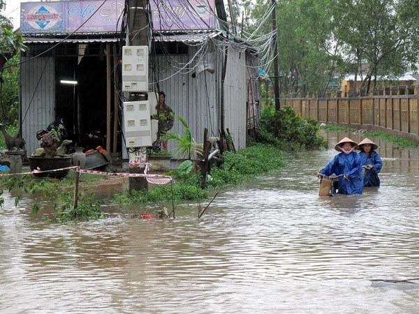
Contents of work on flood monitoring using remote sensing technology in Vietnam (Internet image)
On October 12, 2023, the Minister of Natural Resources and Environment issued Circular 12/2023/TT-BTNMT on Technical regulations for flood monitoring using remote sensing technology in Vietnam.
Contents of work on flood monitoring using remote sensing technology in Vietnam
(1) Preparation work
- Collect and synthesize natural disaster information, including:
+ Forecast information about rainfall, rain time, and rain areas;
+ Storm forecast information includes storm level, direction of travel, time, and scope of the affected area;
+ Collect and synthesize other hydrometeorological forecast and warning information under the national hydrometeorological forecast and warning system.
- Collect information from remote sensing satellites passing through Vietnamese territory, including:
+ Information about satellite management agencies;
+ Information about shooting time and range;
+ Technical specifications of the types of images to be acquired.
- Order remote sensing photos to monitor floods:
+ Determine the location and scope of photography;
+ Time to take photos;
+ Frequency of taking photos;
+ Send a photo request to the agency providing remote sensing image data.
- Receive remote sensing image data before, during, and after flooding.
- Collect maps and information related to the monitoring area, including:
+ Flood monitoring data from domestic and international organizations;
+ Geographic background data;
+ Digital elevation model.
(2) Process remote-sensing images
- Enter input data
+ After quality check, remote sensing images are imported into remote sensing image processing software;
+ Convert the image's grayscale value (DN) to the image's radiation value (dB).
- Enhance photo quality
+ Process and regenerate radar remote sensing image models (SAR Simulation);
+ Correct the influence of terrain on image quality;
+ Noise filtering: Eliminate high-frequency noise while still preserving image characteristics; the filter size is 5x5 pixels or 7x7 pixels to ensure the best results.
- Convert to the VN-2000 National Reference System and Coordinate System.
- Merge, crop images, and export image maps according to the monitoring area.
(3) Extract flood monitoring background data from the national geographic background database
- National land borders, administrative boundaries.
- Provincial-level People's Committee headquarters, district-level People's Committee headquarters, and commune-level People's Committee headquarters.
- National railways, highways, national highways, provincial roads, district roads, and airports.
- Regional hydrological objects with an area larger than 15 mm2 according to the map scale to be established; line-shaped objects with a length greater than 2 cm according to the map scale to be established.
(4) Extract flood information
- Select image polarization in the following order of priority: HH polarization, VH polarization, HV polarization, and VV polarization.
- Determine the threshold radiation value of the water object in the image.
- Separate flooded areas.
- Export flooded area boundaries into vector form.
(5) Edit flood information layer
- Adjust flood information results:
+ Correct the influence of terrain on the results of flooded area extraction;
+ Filter out and summarize flooded areas with an area less than 15 mm2 on the map.
- Edit and smooth the contour of the flooded area: the smoothing parameter is 0.1 mm on the map.
- Filter out flooded areas regularly.
- Calculate the area of flooded areas according to the administrative units of province, district, and commune.
The statistical table of flooded area is specified in Form No. 02, Appendix attached to this Circular.
(6) Establishment of flood monitoring maps
- Flood monitoring maps using remote sensing technology are scaled according to the scope of influence and resolution of the image data used.
- Repair and edit flood monitoring maps according to the regulations of the thematic maps.
- Additional symbol design.
- Present the flood monitoring map.
(7) Check and evaluate the reliability of flood monitoring maps
- Take at least 10 samples from remote sensing image data of areas affected by floods for inspection.
- Compare the flood monitoring map with the sample.
- The reliability of flood monitoring maps must reach over 90%.
- Correct the flood monitoring map after inspection (if any).
(8) Develop flood monitoring reports
- Develop flood monitoring reports using remote sensing technology as prescribed in Form No. 03, Appendix attached to this Circular.
- Develop a report summarizing the results of flood monitoring using remote sensing technology annually according to the provisions in the Form No. 04 Appendix attached to this Circular.
(9) Hand over the product
- Submit flood monitoring maps and flood reports to the managing agency and data-using agency no later than 5 days after the end of the natural disaster.
- Submit a summary report of flood monitoring results using remote sensing technology before December 25 every year.
(Article 5 of Circular 12/2023/TT-BTNMT)
More details can be found in Circular 12/2023/TT-BTNMT taking effect on December 1, 2023.
Ho Quoc Tuan
- Key word:
- remote sensing technology
- in Vietnam
- Number of deputy directors of departments in Vietnam in accordance with Decree 45/2025/ND-CP
- Cases ineligible for pardon in Vietnam in 2025
- Decree 50/2025 amending Decree 151/2017 on the management of public assets in Vietnam
- Circular 07/2025 amending Circular 02/2022 on the Law on Environmental Protection in Vietnam
- Adjustment to the organizational structure of the Ministry of Health of Vietnam: Certain agencies are no longer listed in the organizational structure
- Vietnam aims to welcome 22-23 million international tourists in Vietnam in 2025
-
- Emergency response and search and rescue organizations ...
- 10:29, 11/09/2024
-

- Handling of the acceptance results of ministerial ...
- 09:30, 11/09/2024
-
- Guidance on unexploded ordnance investigation ...
- 18:30, 09/09/2024
-

- Sources of the National database on construction ...
- 16:37, 09/09/2024
-
- General regulations on the implementation of administrative ...
- 11:30, 09/09/2024
-

- Notable new policies of Vietnam effective as of ...
- 16:26, 11/04/2025
-
.Medium.png)
- Notable documents of Vietnam in the previous week ...
- 16:21, 11/04/2025
-
.Medium.png)
- Notable documents of Vietnam in the previous week ...
- 16:11, 02/04/2025
-
.Medium.png)
- Notable new policies of Vietnam to be effective ...
- 16:04, 02/04/2025
-
.Medium.png)
- Notable new policies of Vietnam effective from ...
- 14:51, 21/03/2025
