What day is November 8? What are contents of Management Regulations according to urban planning project, urban design in Vietnam?
What day is November 8?
Based on Article 1 of Decision 1519/QD-TTg in 2008:
Article 1. Annually, November 8 is designated as "Vietnam Urban Day," with the first event organized on November 8, 2008.
The organization of Vietnam Urban Day each year must ensure practicality, thriftiness, and efficiency to encourage and attract the attention of all citizens, urban governments, urban planners, architects, urban development investors, experts, and social-professional organizations to actively participate in the construction and development of urban areas; with forms of commendation and rewards for organizations, individuals, and urban areas with outstanding achievements in planning, construction, and urban management.
Thus, November 8 is Vietnam Urban Day annually.

What day is November 8? What are contents of Management Regulations according to urban planning project, urban design in Vietnam? (Image from the Internet)
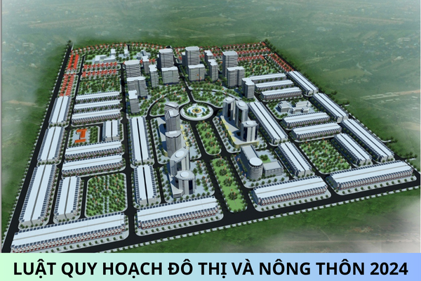
What are types of urban planning in Vietnam?
Based on Article 18 of the Law on Urban Planning 2009 (amended by Clause 3 Article 29 of the Law amending, supplementing some Articles of 37 Laws related to Planning 2018), the types of urban planning are regulated as follows:
Article 18. Types of urban planning
- Urban planning includes the following types:
a) General planning is developed for central-affiliated cities, provincial cities, district-level towns, commune-level towns, and new urban areas.
General planning for central-affiliated cities concretizes provincial planning developed for central-affiliated cities regarding spatial organization, technical infrastructure works, social infrastructure works, and housing for central-affiliated cities;
b) Subdivision planning is developed for areas within cities, district-level towns, and new urban areas;
c) Detailed planning is developed for areas based on development needs, urban management or investment construction requirements.
- Technical infrastructure planning is a content within the general planning project, subdivision planning, detailed planning; for central-affiliated cities, technical infrastructure planning is separately developed into a specialized technical infrastructure planning project.
- The Ministry of Construction regulates the documentation for each type of urban planning.
Thus, urban planning includes the following types:
- General planning is developed for central-affiliated cities, provincial cities, district-level towns, commune-level towns, and new urban areas.
- Subdivision planning is developed for areas within cities, district-level towns, and new urban areas.
- Detailed planning is developed for areas based on development needs, urban management, or investment construction requirements.
What are contents of Management Regulations according to urban planning project, urban design in Vietnam?
Based on Article 35 of the Law on Urban Planning 2009, the content of Management Regulations according to urban planning project, urban design is regulated as follows:
[1] Management regulations according to the general planning project include the following main contents:
- Criteria for area, construction density, land use coefficient, and maximum and minimum height of works in each urban function zone.
- Control of space and architecture within urban areas.
- Red line boundaries of main streets, controlling construction elevations of the urban area.
- Position, scale, and protection scope, safety corridors for underground works.
- Areas prohibited from construction; protection scopes, safety corridors for technical infrastructure works; environmental protection measures.
- Conservation areas, restoration of architectural works, historical, cultural relics, scenic spots, landscape terrain within the urban area.
[2] Management regulations according to the subdivision planning project include the following main contents:
- Boundaries, scope, nature of the planned area.
- Position, boundaries, nature, scale of functional zones within the planned area; criteria for construction density, land use coefficient, maximum and minimum height, construction elevation for each block; red line boundaries, construction boundaries, construction elevations, and specific technical requirements for each road; protection scope, safety corridors for technical infrastructure works.
- Main spatial axes, urban landmarks.
- Position, scale, and protection scope, safety corridors for underground works.
- Conservation, renovation, embellishment of historical relics, cultural scenes, landscape terrain, and environmental protection.
[3] Management regulations according to the detailed planning project include the following main contents:
- Boundaries, scope of the planned area.
- Position, boundaries, function, and scale of lots within the planned area; criteria for construction density, land use coefficient, construction elevation for each lot; height, ground floor, and ceiling of the first floor, architectural form, and boundary fences of works, building materials; red line boundaries, construction boundaries, and specific technical requirements for each road, alley; protection scope, safety corridors for technical infrastructure works.
- Position, scale, protection scope, safety corridors for underground works.
- Conservation, renovation, embellishment of architectural works, historical relics, cultural scenes, scenic spots, landscape terrain, and environmental protection.
[4] Management regulations according to the urban design project include the following main contents:
- Boundaries, scope of the urban design development area.
- Functions, construction density, construction elevation for each lot; number of floors, architectural form of works and boundary fences of works, building materials, ground floor, and ceiling of the first floor, setback of works.
- Public works, small architectural works; covered architecture of urban technical infrastructure works.
- Conservation, renovation, embellishment of architectural works, historical relics, cultural scenes, scenic spots, landscape terrain, and environmental protection.


