Surveying, collecting data to serve the preparation of technical construction plans and estimates for clearance of bombs, mines and explosives in Vietnam
The new regulations on surveying, collecting data to serve the preparation of technical construction plans and estimates for clearance of bombs, mines and explosives in Vietnam

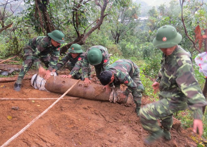
Surveying, collecting data to serve the preparation of technical construction plans and estimates for clearance of bombs, mines and explosives in Vietnam (Image from the Internet)
Article 15 Technical procedures for investigation, survey, and clearance of bombs, mines and explosives issued together with Circular No. 121/2021/TT-BQP (Effective from November 5, 2021) stipulates the survey, data collection for the preparation of technical construction plans, and estimates for bomb, mine and explosive clearance as follows:
Units, organizations conducting investigation, survey, and clearance of mines and explosives have the following responsibilities:
1. Develop investigation and clearance plans along with the authorized area diagram for approval.
2. Notify in writing the local authorities and local military agencies from district level and above about the investigation, survey, and clearance activities in accordance with regulations.
3. Collect information on the characteristics of the mine and explosive contaminated area (area contaminated by mines and explosives, arrangement; level of damage; types, characteristics of mines and explosives used by combat forces in the area where clearance will be conducted) from documents in archives, information from local authorities, armed forces managing the area, and local residents.
4. Install concrete and steel stakes when conducting clearance on land; deploy buoys, turtles for underwater clearance; deploy buoys, turtles combined with GPS coordinates when clearing mines and explosives underwater to mark the scope, area of clearance activities.
5. Conduct surveys on-site to determine:
a) Forest classification, topography, land classification, soil contamination levels, weather, climate, hydrology; population situation in the area and identify the location for setting up camps for mission purposes.
b) Determine the overall signal density by conducting mine and explosive clearance steps at selected locations with dimensions ranging from (25x25) m to (50x50) m representing each type of terrain, for projects with clearance areas of 30 hectares or more, the total area of survey points must be equal to 1% of the total clearance area required; for projects with clearance areas less than 30 hectares, the total area of survey points ranges from 1% to 3% of the total clearance area required, depending on the project's layout. For underwater surveys, survey grids are usually (250 x 50) m with the total area of survey points equal to 3% for clearance areas of 30 hectares or more and 5% for clearance areas less than 30 hectares.
c) The records in the survey documents serving the preparation of technical construction plans, estimates (handover record of land for survey; survey construction diary; acceptance of survey results; survey construction report) shall be carried out according to Form RPBM-01, Form RPBM-02, Form RPBM-03, Form RPBM-04 in Appendix III issued under this Procedure.
6. Mine and explosive clearance work is specialized, so small-scale projects with areas under 30 hectares are assigned to a single unit to conduct surveys, prepare technical construction plans, estimates, and organize mine and explosive clearance operations.
Best Regards!


