Requirements for Minimum Knowledge and Skills in Construction Geodesy (CD)
On December 23, 2019, the Ministry of Labor, Invalids, and Social Affairs issued Circular 21/2019/TT-BLDTBXH stipulating the minimum amount of knowledge and competency requirements that students must achieve upon graduation at the intermediate level and college level for disciplines and professions in the fields of computer technology, information technology, and technical technology.
 Article table of contents
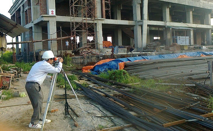
Requirements for minimum knowledge and skills in the Construction Geodesy (CD) sector (Illustration image)
As stipulated in the regulations attached with Circular 21/2019/TT-BLDTBXH, specifying the requirements for the amount of knowledge and minimum skill requirements that learners must achieve after graduating from the Construction Geodesy sector as follows:
Regarding Knowledge
- Explain the structure, operating principles, uses, technical parameters, and errors of common geodetic devices such as: Theodolite, Leveling Instrument, Electronic Total Station, GNSS Satellite Positioning Device;
- Explain the process of using, maintaining, checking, and calibrating the errors of geodetic devices;
- List the measurement units and commonly used coordinate systems in geodesy;
- Explain the concepts of maps, topographic maps, and construction cross-sections;
- Analyze the process and methods of building control networks using traditional methods and GNSS technology;
- Explain the process of measuring, creating, checking, calibrating, inspecting, and delivering area topographic maps;
- Explain the process of measuring and drawing construction cross-sections;
- Explain the methods of establishing boundaries, arranging construction projects;
- Explain the methods of construction inspection, as-built survey measurements;
- Analyze the process and methods of checking, calibrating, inspecting, and delivering geodesy documents for construction projects;
- Explain the process of using geodetic software to create area topographic maps and geodesy for construction;
- Analyze the process of monitoring construction deformation;
- Explain the methods of planning, organizing construction, ensuring labor safety, and evaluating the work process results;
- Explain the basic knowledge of politics, culture, society, law, national defense, security, and physical education as prescribed;
- Explain basic computing knowledge and basic level foreign language proficiency (Level 2/6) according to the Vietnamese 6-level foreign language competency framework.
Regarding Skills
- Proficiently use common geodetic devices such as: Theodolite, Leveling Instrument, Electronic Total Station, GNSS Satellite Positioning Device;
- Check and calibrate the errors of common geodetic devices such as: Theodolite, Leveling Instrument, Electronic Total Station, GNSS Satellite Positioning Device;
- Build control networks for base positioning, topographic surveys, and construction;
- Proficiently use methods of angle measurement, distance measurement, coordinate measurement, and height measurement;
- Calculate and adjust geodetic data to serve the design, layout, and construction supervision;
- Measure, create area topographic maps, and construction cross-sections;
- Proficiently read technical design drawings;
- Lay out boundaries and construction projects from design drawings to the field;
- Inspect construction and conduct as-built survey measurements accurately according to regulations;
- Inspect, calibrate, inspect, and deliver products accurately;
- Measure, calculate, analyze, and predict construction deformation;
- Proficiently apply procedures, regulations, and technical standards in construction geodesy;
- Proficiently use geodetic software for creating area topographic maps and construction cross-sections;
- Create efficient construction plans ensuring labor safety during execution;
- Apply new technologies and green skills meeting the requirements of the Industry 4.0 revolution in construction geodesy;
- Use basic information technology as prescribed and apply it in some professional tasks of the sector and occupation;
- Use basic foreign language proficiency Level 2/6 in the Vietnamese 6-level foreign language competency framework and apply it in some professional tasks of the sector and occupation.
Regarding Autonomy and Responsibility
- Be careful, meticulous, and serious in work;
- Have the ability to work independently or in a team, solve complicated tasks in changing working conditions;
- Have the ability to guide and supervise others in task execution, evaluate the performance of individuals and team members, ensuring the plan and progress of tasks assigned;
- Have professional ethics, be honest with measurement, calculation, adjustment, and construction layout results;
- Be responsible for personal work and team work;
- Ensure safety for people, machines, equipment, and tools during task execution;
- Adhere to procedures for checking and calibrating geodetic devices and tools.
For details, see the regulation at Circular 21/2019/TT-BLDTBXH, effective from February 6, 2020.
Le Vy
- Conditions for individuals to become state audit collaborators in Vietnam from September 27, 2024
- Powers and duties of State audit collaborators in Vietnam from September 27, 2024
- Regulations on opening traffic accounts in Vietnam from October 1, 2024
- Regulations on payment of road use charges via ETC in Vietnam
- Proposal on Commune-level health workforce in Vietnam
- Proposal for specialized inspection procedures of the People's Public Security Forces in Vietnam
-
- 9-digit ID cards will stay valid in Vietnam until ...
- 11:02, 05/10/2024
-

- Conditions for individuals to become state audit ...
- 10:00, 05/10/2024
-

- Regulations on the number and Composition of the ...
- 11:01, 04/10/2024
-

- Powers and duties of State audit collaborators ...
- 10:00, 04/10/2024
-

- Conditions for establishing a public health service ...
- 07:59, 04/10/2024
