Determining Land Used for Incorrect Purposes and Not Yet Used in Accordance with Regulations
Recently, the Ministry of Natural Resources and Environment issued Circular 45/2011/TT-BTNMT providing guidance on determining areas of land used for incorrect purposes, encroached upon, or not yet utilized for the purpose of calculating non-agricultural land use tax.

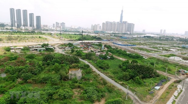
Method of determining land used for improper purposes, not yet used according to regulations (Illustration)
According to Circular 45/2011/TT-BTNMT, the method for determining the area of land used for improper purposes, land not yet used according to regulations is carried out as follows:
- In the case where the entire parcel is used for improper purposes or not yet used according to regulations, the determination of the area of land used for improper purposes, land not yet used according to regulations is as follows:
- Determine according to lawful documents on land use rights. In the case where the land user has multiple lawful documents on land use rights, determine according to the document with the most recent signing date;- In the case where there is already a cadastral map (approved according to regulations) drawn after the signing date of the lawful document on land use rights, determine according to that cadastral map.
In the case where after the signing date of the lawful document on land use rights, the land-using organization has carried out cadastral mapping and declared land use according to Directive 31/2007/CT-TTg dated December 14, 2007 of the Prime Minister of the Government of Vietnam on the inventory of land funds managed and used by organizations assigned or leased land by the State (hereinafter referred to as Directive 31/2007/CT-TTg), the determination shall be according to that cadastral mapping.
- In the case where a part of the parcel is used for improper purposes or not yet used according to regulations, the determination of the area of land used for improper purposes, land not yet used according to regulations is as follows:
- In cases where there is already a cadastral map showing the scope of land used for improper purposes, land not yet used according to regulations, determine according to that cadastral map;- In cases where the land-using organization has carried out cadastral mapping and declared land use according to Directive 31/2007/CT-TTg and it is still consistent with the current land use status, the determination shall be according to the results of that cadastral mapping and declaration;- In cases where there is no cadastral map, or cadastral mapping and declaration of land use according to Directive 31/2007/CT-TTg have not been carried out, the area of land used for improper purposes and land not yet used according to regulations is determined according to the actual use at the time of tax declaration. The land user shall self-determine the area for tax declaration and is responsible before the law for the content of that declaration.
More details can be found in Circular 45/2011/TT-BTNMT, effective from February 10, 2012.
Thuy Tram
- Directive on stabilizing the market in Vietnam at the end of 2024 and during the Lunar New Year in 2025
- Guidelines for determining the functions and scope of water source protection corridors in Vietnam from January 10, 2025
- Guidelines on the collection of information related to water sources requiring the establishment of water source protection corridor in Vietnam from January 10, 2025
- Mandatory functions of online banking application software in Vietnam from January 1, 2025
- Guidelines for classifying road motor vehicles by purpose of use in Vietnam from January 1, 2025
- Reorganization of administrative units in Phu Tho province from January 01, 2025
-

- Directive on stabilizing the market in Vietnam ...
- 15:18, 27/11/2024
-

- Guidelines for determining the functions and scope ...
- 09:05, 27/11/2024
-

- Guidelines on the collection of information related ...
- 09:02, 27/11/2024
-

- Mandatory functions of online banking application ...
- 08:30, 27/11/2024
-

- Guidelines for classifying road motor vehicles ...
- 08:00, 27/11/2024
 Article table of contents
