What are regulations on the List of abbreviations on cadastral maps in Vietnam?
What is cadastral map in Vietnam? What are regulations on the List of abbreviations on cadastral maps in Vietnam? What are symbols for land features on cadastral maps in Vietnam?
What is cadastral map in Vietnam?
Pursuant to Article 3 of the Law on Land in 2013 stipulating cadastral map:
Interpretation of terms
In this Law, the terms below are construed as follows:
1. Land parcel means a land area delimited by boundaries determined in the field or described in records.
2. Land use master plan means the distribution and zoning of land by use space to serve the objectives of socio-economic development, national defense, security, environmental protection and climate change adaptation based on the land potential and land use demands of all sectors and fields, for each socio-economic region or administrative unit in a given period of time.
3. Land use plan means the division of a land use master plan according to periods of time for implementation during the period of the land use master plan.
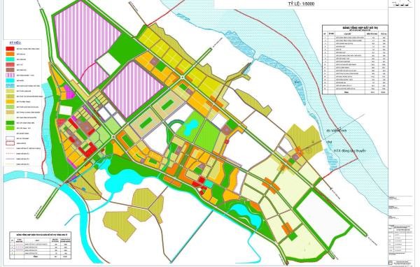
4. Cadastral map is a map that shows the land parcels and related geographic elements, and is made according to administrative units of communes, wards or townships, and certified by a competent state agency.
...
As regulated above, cadastral map is a map that shows the land parcels and related geographic elements, and is made according to administrative units of communes, wards or townships, and certified by a competent state agency.
What are regulations on the List of abbreviations on cadastral maps in Vietnam? - image from the internet
What are regulations on the List of abbreviations on cadastral maps in Vietnam?
Based on Section 2 of Appendix 1 issued together with Circular 25/2014/TT-BTNMT, which regulates abbreviations on cadastral maps, the specific list of abbreviations on current cadastral maps is as follows:
|
|
|||||
|
Note content |
Abbreviation |
Note content |
Abbreviation |
Note content |
Abbreviation |
|
River * |
Sg. |
Mountain * |
N. |
Hospital * |
Bv. |
|
Stream * |
S. |
Residential area |
KTT |
School * |
Trg. |
|
Canal * |
K. |
Hotel |
Ks. |
Farm * |
Nt. |
|
Rivulet * |
Ng. |
Restricted area |
Cấm |
Forest * |
Lt. |
|
Creek * |
L. |
Camp, Nursing home |
Đ.dưỡng |
Construction site * |
Ct. |
|
Ditch * |
D. |
Cultural center |
NVH |
Company * |
Cty. |
|
Estuary * |
R.M. |
District-level town * |
TX. |
Livestock farm |
Chăn nuôi |
|
Bay * |
V. |
Commune-level town * |
TT. |
Church |
N.thờ |
|
Marsh * |
Vg. |
District * |
H. |
Park |
C.viên |
|
Island *. |
Đ. |
Village of ethnic people * |
B. |
Post office |
BĐ |
|
Archipelago * |
Qđ. |
Hamlet * |
Th. |
Club |
CLB |
|
Peninsula * |
Bđ. |
Village * |
Lg. |
Military camp |
Q.đội |
|
Cape * |
M. |
Small village of ethnic people * |
Mg. |
Cooperative |
HTX |
|
Cave * |
Hg. |
Neighborhood * |
X. |
||
|
Cavern *. |
Đg. |
People's Committee |
UB |
||
What are symbols for land features on cadastral maps in Vietnam?
According to Section 13 of Appendix 1 issued together with Circular 25/2014/TT-BTNMT, the symbols for land features represented on cadastral maps in Vietnam are as follows:
|
No. |
Land type |
Symbol |
|
I |
AGRICULTURAL LAND GROUP |
|
|
1 |
Specialized land for growing rice. |
LUC |
|
2 |
Remaining paddy fields. |
LUK |
|
3 |
Rice paddy. |
LUN |
|
4 |
Land for annual crop cultivation is different. |
BHK |
|
5 |
Farmland planting different crops every year. |
NHK |
|
6 |
Land for perennial crops |
CLN |
|
7 |
Production forest land |
RSX |
|
8 |
Protective forest land |
RPH |
|
9 |
Special-use forest land |
RDD |
|
10 |
Land for aquaculture and fish farming |
NTS |
|
11 |
Salt production land |
LMU |
|
12 |
Other agricultural land |
NKH |
|
II |
NON-AGRICULTURAL LAND GROUP |
|
|
1 |
Rural residential land |
ONT |
|
2 |
Urban residential land |
ODT |
|
3 |
Land for office buildings |
TSC |
|
4 |
Land for institutional buildings |
DTS |
|
5 |
Land for cultural facilities |
DVH |
|
6 |
Land for healthcare facilities |
DYT |
|
7 |
Land for educational and training facilities |
DGD |
|
8 |
Land for sports facilities |
DTT |
|
9 |
Land for scientific and technological facilities |
DKH |
|
10 |
Land for social service facilities |
DXH |
|
11 |
Land for diplomatic facilities |
DNG |
|
12 |
Land for other public works |
DSK |
|
13 |
Defense land |
CQP |
|
14 |
Security land |
CAN |
|
15 |
Industrial zone land |
SKK |
|
16 |
Export processing zone land |
SKT |
|
17 |
Industrial cluster land |
SKN |
|
18 |
Non-agricultural production base land |
SKC |
|
19 |
Commercial and service land |
TMD |
|
20 |
Land used for mining activities |
SKS |
|
21 |
Land for production of construction materials and ceramics |
SKX |
|
22 |
Transportation land |
DGT |
|
23. |
Irrigation land |
DTL |
|
24 |
Energy infrastructure land |
DNL |
|
25 |
Post and telecommunications infrastructure land |
DBV |
|
26 |
Community living land |
DSH |
|
27 |
Public recreational and entertainment land |
DKV |
|
28 |
Market land |
DCH |
|
29 |
Historical and cultural heritage land |
DDT |
|
30 |
Scenic landscape land |
DDL |
|
31 |
Waste disposal and treatment land |
DRA |
|
32 |
Other public infrastructure land |
DCK |
|
33 |
Religious base land |
TON |
|
34 |
Belief base land |
TIN |
|
35 |
Land for cemeteries, burial grounds, funeral homes, crematoriums |
NTD |
|
36 |
Land for rivers, streams, canals, ditches, springs |
SON |
|
37 |
Land with specialized water use |
MNC |
|
38 |
Other non-agricultural land |
PNK |
|
III |
UNUSED LAND GROUP |
|
|
1 |
Unused flat land |
BCS |
|
2 |
Unused hilly and mountainous land |
DCS |
|
3 |
Rocky mountains without forests |
NCS |
Best regards!