What is a future land use map under the law in Vietnam? Which agency measures and prepares the future land use map in Vietnam?
What is a future land use map under the law in Vietnam?
Pursuant to Article 3 of the Land Law 2024:
Article 3. Definitions
In this Law, the terms below are understood as follows:
- Cadastral map is a map that shows parcels and related geographic objects, prepared according to the administrative unit of the commune level or at the district level where no commune-level administrative unit is established, and certified by competent state authorities.
- Current land use map is a map that shows the distribution of land types at a specific point in time, prepared for each administrative unit at different levels and for each socio-economic region.
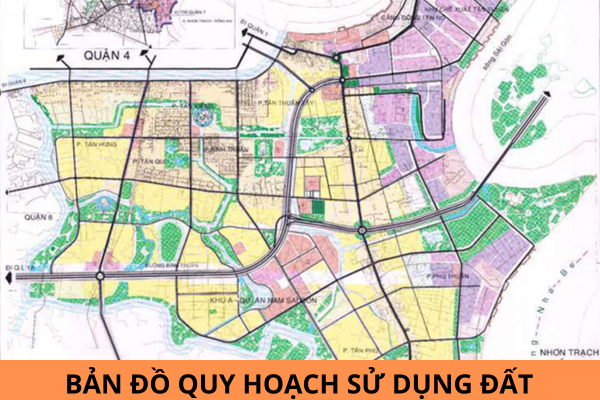
- future land use map is a map prepared at the beginning of the planning period, showing the distribution of land types at the end of the planning period for that plan.
- Land protection, improvement, and restoration is the application of management, technical, mechanical, biological, and organic measures to treat contaminated land and restore degraded land.
- Land compensation is the State returning the value of land use rights for the recovered land area to the person whose land is recovered.
[...]
According to the above regulation, the future land use map is a map prepared at the beginning of the planning period, showing the distribution of land types at the end of the planning period for that plan.

What is a future land use map under the law in Vietnam? Which agency measures and prepares the future land use map in Vietnam? (Image from the Internet)
Which agency measures and prepares the future land use map?
Pursuant to Article 1 of Decision 06/2004/QD-BTNMT, it is stipulated on the position and function:
Article 1. Position and Function
The Department of Land Registration and Statistics is an organization under the Ministry of Natural Resources and Environment, with the function of assisting the Minister in state management of land survey, evaluation, ranking; land use planning and plans; land allocation, leasing, and recovery; cadastral mapping, current land use mapping, future land use mapping; land registration and statistics; information, and archiving of land management documents.
According to the above regulation, the Department of Land Registration and Statistics under the Ministry of Natural Resources and Environment of Vietnam measures and prepares the future land use map.
What are the rules for formulating land use planning and land use plans in Vietnam?
Pursuant to Article 60 of the Land Law 2024, the rules for formulating land use planning and land use plans in Vietnam are stipulated as follows:
- The preparation of land use planning at all levels must comply with the principles and relationships between different types of planning as prescribed by the Planning Law.
- Land use planning at all levels must aggregate and balance the land use needs of sectors and fields that use the land.
- National land use planning must ensure the specificity and regional linkage; ensure the balance between the land use needs of sectors, fields, and localities, and be appropriate to the national land potential to use land economically and efficiently.
- Land use planning and plans prepared at national, provincial, and district levels must meet the requirements for the rapid and sustainable socio-economic development strategy; ensure national defense and security.
- Ensure consistency and synchronization; higher-level land use planning must ensure the land use needs of lower levels; lower-level land use planning must be consistent with higher-level land use planning; district-level land use planning must determine the land use contents down to the commune level; land use plans must be consistent with the land use planning of the same level approved by the competent authority.
- The content of land use planning must combine land use indicators linked with space, land use zoning, and natural ecosystems.
- Use land economically and efficiently; rationally exploit natural resources and protect the environment; adapt to climate change; ensure national food security and forest cover; conserve, embellish, and promote the value of historical-cultural relics, and scenic spots.
- Ensure continuity, inheritance, stability, specificity, and the linkage of socio-economic regions; balance harmoniously between sectors, fields, localities, and generations; be suitable with the land potential.
- The preparation of land use planning and plans at all levels must ensure the participation of political-social organizations, communities, and individuals; ensure publicity and transparency.
- Land use planning at all levels is prepared simultaneously; higher-level land use planning must be decided and approved before lower-level land use planning. When the land use planning period ends but the next period's land use planning has not been decided and approved by the competent authority, the unused land use indicators will continue to be implemented until the next period's land use planning is decided and approved by the competent state authority.
- Land use plans are prepared simultaneously with the preparation and adjustment of land use planning at the same level. The land use plan for the first year of district-level land use planning is prepared simultaneously with the preparation of district-level land use planning.


