Can disputed land be divided into parcels?
Are disputed lands allowed for parcel separation?
Based on Article 220 of the Land Law 2024 regulating parcel separation and merger:
Parcel Separation and Merger
- The parcel separation and merger must ensure the following principles and conditions:
a) The land parcel has been issued one of the following types of certificates: Certificate of land use rights, Certificate of house ownership and homestead land use rights, Certificate of land use rights, house ownership and other assets attached to the land, Certificate of land use rights, ownership of assets attached to the land;
b) The land parcel is within the land use term;
c) The land is not in dispute, not subject to seizure for enforcement of judgments, and not subject to emergency measures by a competent state agency.
In case of disputed land where the disputed area boundaries can be determined, the non-disputed portion of the parcel is allowed for parcel separation or merger;
d) The parcel separation and merger must ensure access roads; connection to existing public roads; reasonable water supply, drainage and other necessary requirements. In case the land user allocates a part of the residential parcel or homestead land and other land within the same parcel for passage, parcel separation or merger does not require changing the land use purpose for the part of the land allocated for the passage.
...
According to the above regulations, land that is certified, within the land use term, not in dispute, not subject to seizure for enforcement of judgments, and not subject to emergency measures by a competent state agency is one of the principles and conditions for the implementation of parcel separation.
Therefore, disputed land is not allowed for parcel separation.

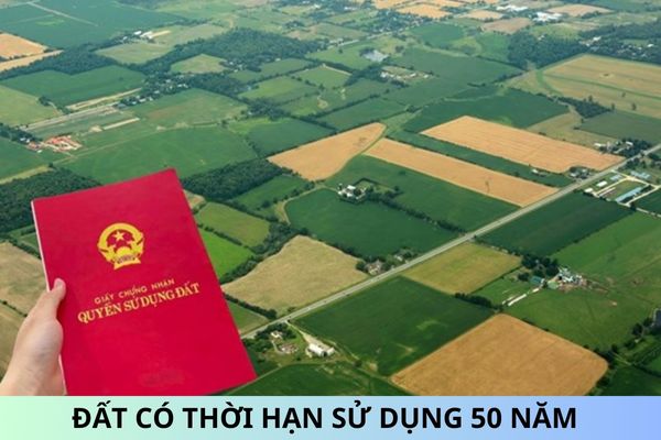
Disputed lands allowed for parcel separation? (Image from Internet)
How is parcel information represented on the certificate?
Based on Article 33 of Circular 10/2024/TT-BTNMT regulating information on parcels:
Parcel Information
The information on parcels at item 2 on the Certificate includes the following details and representations:
Records "Parcel number: …; map sheet number: ..." according to the provisions of clause 1, Article 8 of this Circular.
Information on the area is represented according to the provisions of clause 2, Article 8 of this Circular.
Information on land type is represented according to the provisions of clause 3, Article 8 of this Circular.
Information on the land use term is represented according to the provisions of clause 4, Article 8 of this Circular.
Information on the form of land use is represented according to the provisions of clause 5, Article 8 of this Circular.
Address information is represented according to the provisions of clause 6, Article 8 of this Circular.
Information specified in clauses 1, 2, 3, 4, 5, and 6 of this Article and other parcel information specified in Article 8 of this Circular are shown in the QR code on the Certificate.
Accordingly, parcel information on the certificate is represented as follows:
[1] Records "Parcel number: …; map sheet number: ..." as follows:
- The sheet number is the ordinal number of the cadastral map sheet or the identification number of the cadastral map extracted according to cadastral mapping regulations.
- The parcel number is the ordinal number of the parcel on each cadastral map sheet or the identification number of the parcel according to the extracted cadastral map according to cadastral mapping regulations.
[2] The information on the area is represented as follows:
- Area: determined in square meters (m2), rounded to one decimal place.
- In case the parcel spans multiple administrative units at the commune level within the certification authority's jurisdiction, additional information should be shown: "of which: ...m2 belongs to ... (name of the administrative unit at the commune level); ...m2 belongs to …"
- For parcels with apartment buildings, the area for constructing the apartment building should also be shown.
[3] Information on land type includes the name and code (symbol) of the land type.
[4] Information on the land use term is represented as follows:
- In case of land allocation or lease by the State, the term according to the Land Allocation or Lease Decision is recorded.
- For other cases, the land use term is recorded according to land law regulations.
- In cases where the parcel has multiple land types with different use terms, each land type and its respective term are recorded sequentially. For example: "Use term: Residential land in rural areas: Permanent; Perennial crop land: 50 years from the date of certificate issuance."
- For land registration without certificate issuance, "Not yet determined" is recorded.
- For land allocated for management by the State, the term is recorded according to the land allocation document for management. If there is no such document or it does not specify the term, "Not yet determined" is recorded.
[5] Information on the form of land use includes both common and individual use forms.
[6] Parcel address information includes: house number, street name (if any); name of the residential area (block, hamlet, village, sub-village, neighborhood) or area name, field (for parcels outside residential areas); name of the administrative units at commune, district, and province levels where the parcel is located.
What information is included in the cadastral records?
According to clause 1, Article 6 of Circular 10/2024/TT-BTNMT regulating information on parcels and line features, the information includes:
- Identification number;
- Address;
- Boundaries;
- Area;
- Land type;
- Form of land use;
- Land use term;
- Origin of land use;
- Information on financial obligations;
- Information on restrictions on land use rights, rights to adjacent parcels (if any);
- Information on measurement documents.


