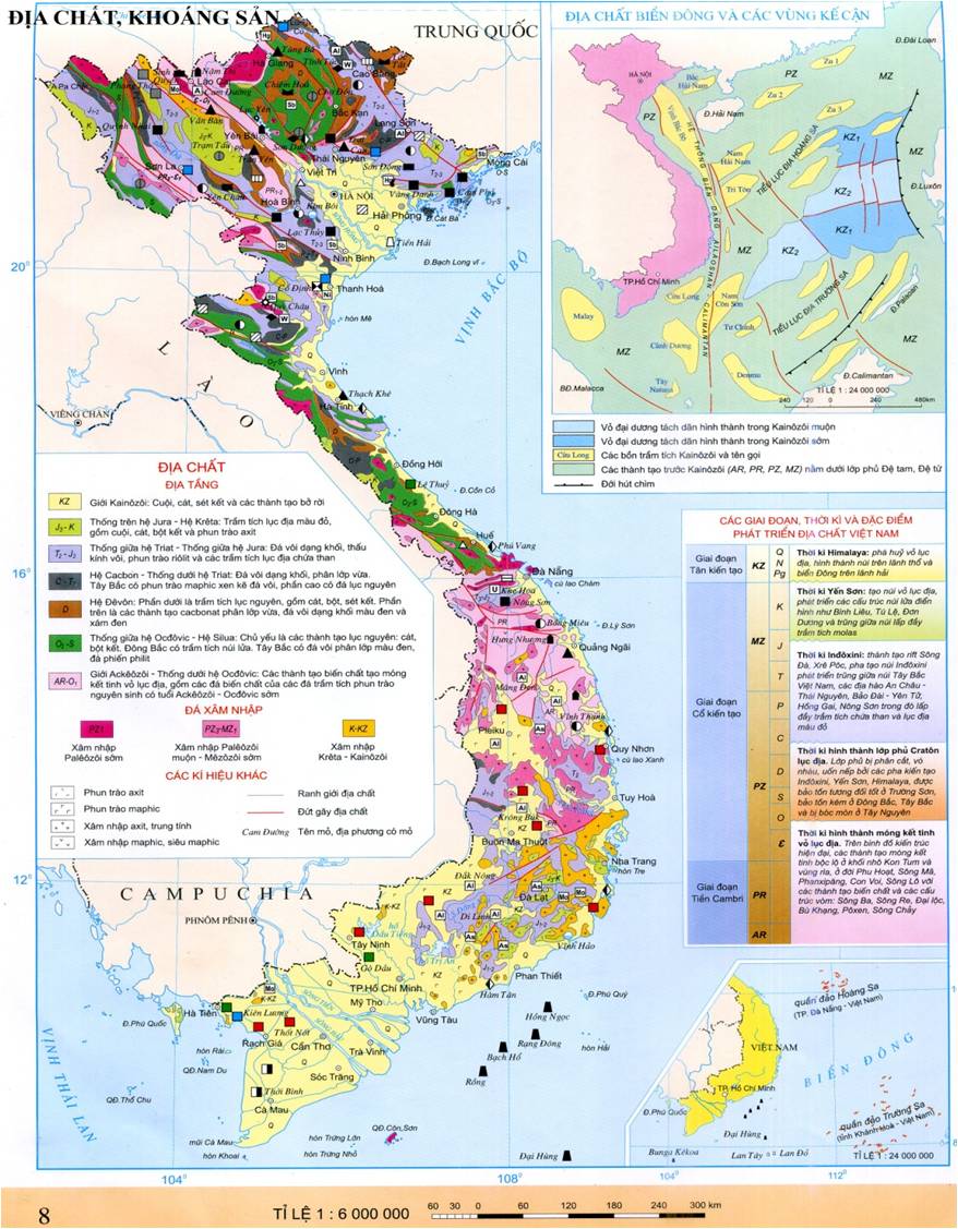
Mapping of Geological Structures at a Scale of 1:50,000 for Mineral Resource Prospect Prediction
This is a notable content in the National Technical Regulation on the geological mapping of mineral resources at a scale of 1:50,000 for terrestrial areas, issued together with Circular 23/2012/TT-BTNMT of the Ministry of Natural Resources and Environment.

Geological mapping at a scale of 1:50,000 for mineral prospect prediction (Illustration)
To be specific, in Item 3, Part I of the National Technical Regulation on geological mapping for mineral prospect prediction at a scale of 1:50,000 of mainland and offshore islands issued along with Circular 23/2012/TT-BTNMT, the objectives for geological mapping at a scale of 1:50,000 on mainland and offshore islands are to create geological maps at a scale of 1:50,000, discover and predict mineral prospects and other geological resources; determine the current status of the geological environment and anticipate geological disasters.
In addition, the tasks of geological mapping for mineral prospects at a scale of 1:50,000 on mainland and offshore islands are specified as follows:
- Study the material composition, delineate distribution areas, and clarify the relationships of geological bodies, structures, and geological development history.- Discover and delineate areas with mineral prospects; predict mineral potential; establish the distribution laws of various minerals and the premises, signs for their discovery.- Determine the location, scale, causes, and predict the likelihood of geological disasters, geological anomalies, geochemistry, geophysics in the geological environment; areas containing hazardous minerals.- Discover and delineate areas with favorable geological features for groundwater storage and transportation.- Investigate and delineate points and areas of geological preservation significance, with potential to become geological heritage sites.- In areas designated for the development of economic, defense infrastructure, population distribution, geological mapping at a scale of 1:50,000 combined with hydrogeological and engineering geological investigations will serve as a basis for reasonable land use planning.- The content of geological mineral investigations is carried out according to thematic studies. The number of thematic studies conducted depends on the geological and mineral characteristics of the investigation area but must be anticipated from the proposal stage and adjusted appropriately during implementation.
For further details, see Circular 23/2012/TT-BTNMT, effective from March 5, 2013.
Le Vy
- Number of deputy directors of departments in Vietnam in accordance with Decree 45/2025/ND-CP
- Cases ineligible for pardon in Vietnam in 2025
- Decree 50/2025 amending Decree 151/2017 on the management of public assets in Vietnam
- Circular 07/2025 amending Circular 02/2022 on the Law on Environmental Protection in Vietnam
- Adjustment to the organizational structure of the Ministry of Health of Vietnam: Certain agencies are no longer listed in the organizational structure
- Vietnam aims to welcome 22-23 million international tourists in Vietnam in 2025
-

- Notable documents of Vietnam in the previous week ...
- 17:29, 05/03/2025
-

- Number of deputy directors of departments in Vietnam ...
- 15:04, 05/03/2025
-

- Cases ineligible for pardon in Vietnam in 2025
- 14:43, 05/03/2025
-

- Decree 50/2025 amending Decree 151/2017 on the ...
- 12:00, 05/03/2025
-

- Circular 07/2025 amending Circular 02/2022 on ...
- 11:30, 05/03/2025
 Article table of contents
