Vietnam: Instructions on how to check Hanoi's planning

What are the contents of the national land use planning in Vietnam?
Pursuant to Article 24 of the Law on Planning in 2017 stipulating contents of the national land use planning as follows:
(1) The national land use planning shall specify distribution and organization of spaces used for the purposes of socio-economic development, national defense and security assurance, environmental protection, natural disaster management and climate change resilience according to land potentials and demand for land use by inter-regional and inter-provincial fields and sectors.
(2) The national land use planning includes the following main parts:
a) Analysis and assessment of factors, natural conditions, resources, conditions directly affecting and use of land by fields and sectors.
b) Forecasting of trends in fluctuation of land use;
c) Viewpoints and objectives for land use during the new period;
d) Orientation for distribution of spaces and quotas for use of farming land and forest land;
dd) Orientation for distribution of spaces and quotas for use of non-farming land;
e) Unused land space;
g) Solutions and resources for planning implementation at item (2).
Thus, the national land use planning aims to direct the rational, efficient and effective use of land throughout Vietnam. In addition, effective national land use planning shall fulfill the needs of development and environmental protection, as well as respond to climate change and natural disasters.
What are procedures for formulation of the national land use planning in Vietnam?
Pursuant to Article 16 of the Law on Planning in 2017 stipulating procedures for formulation of the national land use planning in Vietnam as follows:
Step 1: The planning authority shall take charge and cooperate with Relevant Ministries, ministerial authorities and local governments in determining planning tasks and submitting them to the Government for approval.
Step 2: The planning authority shall select a planning consultancy; take charge and cooperate with relevant Ministries, ministerial authorities and local governments in formulating planning; analyze, assess and forecast factors, conditions, resources, development situation, assess national socio-economic development, propose viewpoints, objectives and prioritized development orientations serving as a basis for planning formulation;
Step 3: Relevant Ministries, ministerial authorities and local governments shall select a consultancy to develop the parts of the planning contents and appraise such parts before they are submitted to the planning authority;
Step 4: The planning authority shall take charge and cooperate with Relevant Ministries, ministerial authorities and local governments in considering and addressing common, inter-regional and inter-provincial issues to ensure uniformity and effectiveness of the planning; propose adjustments to contents of the planning developed by relevant Ministries, ministerial authorities and local governments;
Step 5: Relevant Ministries, ministerial authorities and local governments shall adjust and complete parts of the planning and send them to the planning authority;
Step 6: The planning authority shall complete the planning and send it for enquiry as prescribed in Article 19 of the Law on Planning in 2017;
Step 7: The planning authority shall respond to opinions, complete the planning and submit it to the planning appraisal council;
Step 8: The planning authority shall complete the planning according to the conclusion of the planning appraisal council, report it to the Prime Minister, who will submit it to the National Assembly.
As regulations above, the procedures for national land use planning aims to ensure the participation and close coordination between central and local authorities in order to build a strategic plan that is in line with the sustainable development trend of the country in the future. At the same time, the procedures for national land use planning may assess the potential, current land use and forecast the trend of socio-economic development to correctly identify the land use needs for industries, sectors and localities in order to propose reasonable and effective land use goals and orientations.
How to check Hanoi's planning?
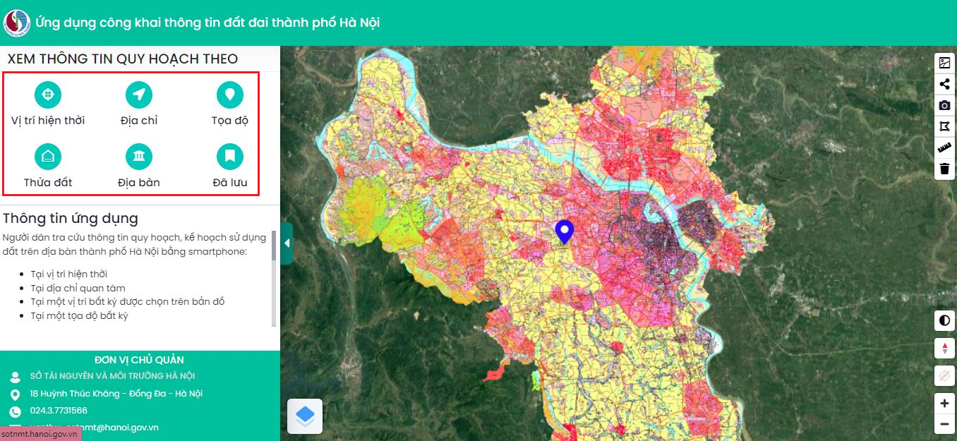
To check Hanoi's planning, you need to follow these steps:
Step 1. Visit the website https://quyhoach.hanoi.vn/ or http://qhkhsdd.hanoi.gov.vn/.
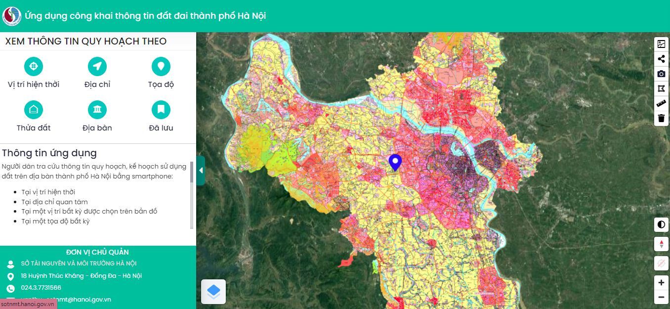
Step 2. Enter the information of the place where you want to check Hanoi's planning.
- Current location;
- Address;
- Location;
- Plot of land;
- Land;
Saved items: is the history of searched addresses.
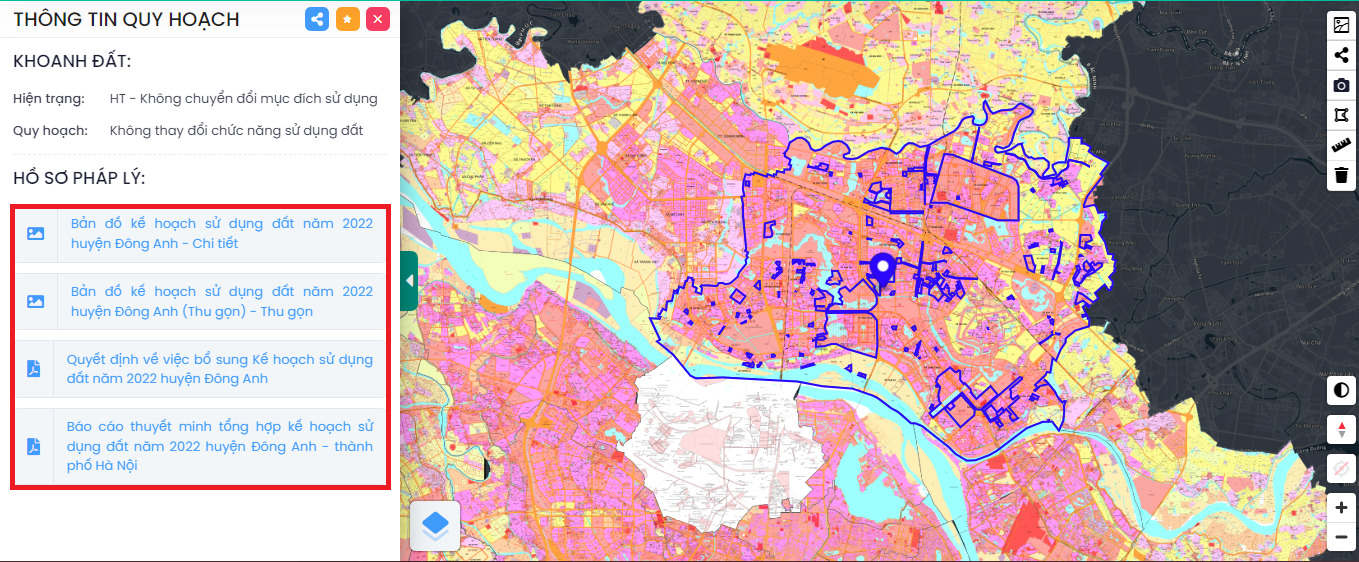
Explanation: The color code is used to distinguish the current status of each type of land, the allocation of the upper-level planning…
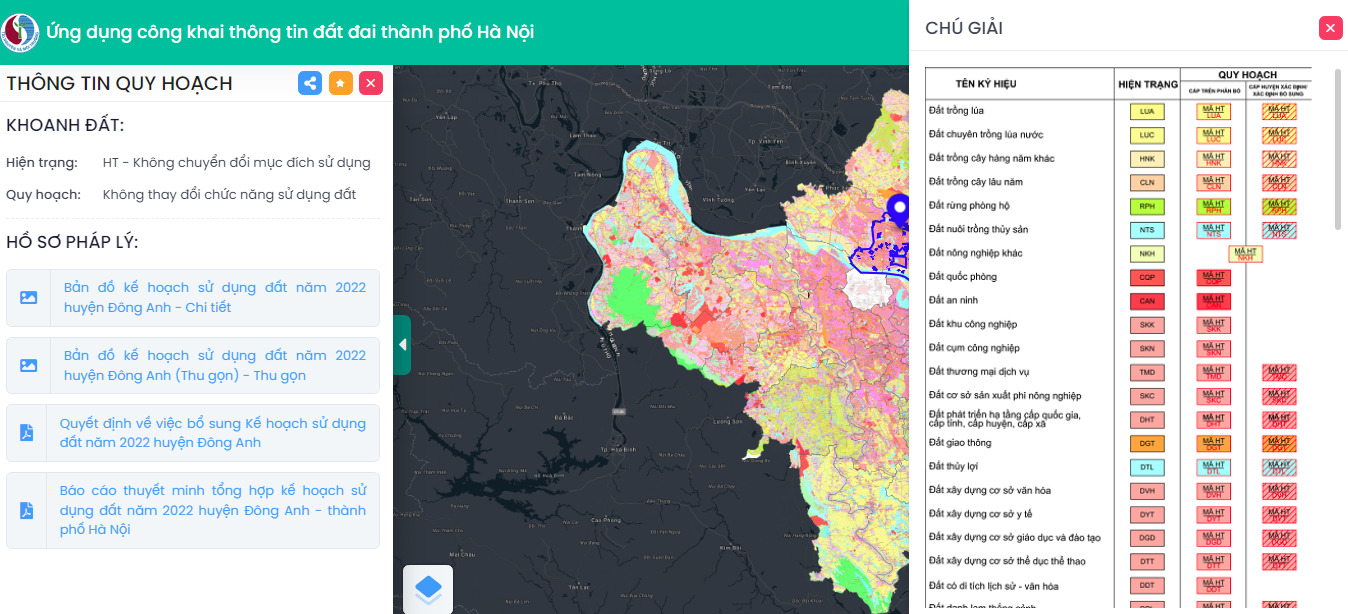
Step 3. After entering the information, the interface will display the planning information.
For example, when clicking on the area item and entering Sơn Tây, the planning information will be displayed as follows:
Please Login to be able to download


-

-
Address: 17 Nguyen Gia Thieu, Vo Thi Sau Ward, District 3, Ho Chi Minh City Phone: (028) 7302 2286 (6 lines) E-mail: [email protected]
Editorial Director: Mr. Bui Tuong Vu - Tel. (028) 7302 2286
P.702A , Centre Point, 106 Nguyen Van Troi, Ward 8, Phu Nhuan District, HCM City;