What is remote sensing? Principles of remote sensing activities in Vietnam

What is remote sensing? What are the principles of remote sensing activities in Vietnam? – Minh Tuan (Hoa Binh)
 Article table of contents
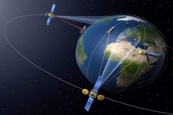
What is remote sensing? Principles of remote sensing activities in Vietnam (Internet image)
Regarding this issue, LawNet would like to answer as follows:
1. What is remote sensing?
According to Clause 1, Article 3 of Decree 03/2019/ND-CP, remote sensing means the science and technology of studying and collecting information about geographic objects or targets without making physical contact with them.
2. Principles of remote sensing activities in Vietnam
- Remote sensing image data, superdata and products must be updated regularly, must be provided sufficiently, accurately and punctually to meet the requirements of socio-economic development, observation and monitoring of natural resources, environment, rescue, salvation, prevention and control of natural disasters, national defence and security.
- Remote sensing image data collection infrastructure which is built by using the state budget funds shall be deemed as public assets, inherited, commonly used, managed and protected as per laws.
- National remote sensing database must be maintained, operated and updated frequently in order to build and update the national geographic database, the topographic map and the national geospatial data, and must comply with laws on cybersecurity.
- The central government’s budget shall provide ministries, ministry-level agencies and Governmental bodies with funds for exercise of the regulatory authority over remote sensing activities; building and operation of remote sensing data acquisition systems; acquisition, storage, processing, provision, exploitation and usage of remote sensing image data; building of remote sensing image databases.
- The local government’s budget shall provide People's Committees of all levels with funds for exercise of the regulatory authority over remote sensing activities; acquisition, storage, processing, provision, exploitation and usage of remote sensing image data; building of remote sensing image data within their jurisdiction.
(Article 4 of Decree 03/2019/ND-CP)
3. List of preferred remote sensing science and technology activities in Vietnam
List of preferred remote sensing science and technology activities is specified in Article 5 of Decree 03/2019/ND-CP, including:
- Conduct researches on scientific bases for improvement of remote sensing law and institution.
- Research , apply and transfer high, advanced and innovative remote sensing technologies intended for basic surveys, management, monitoring and surveillance of mining and usage of natural resources and environmental protection, prevention, control and mitigation of consequences of natural disasters, response to climate change, rescue, salvation and remediation of environmental accidents and emergencies; take control of and manage territory, national defence, security, and give direction and administration over agricultural production activities; conduct basic earth researches.
(Article 5 of Decree 03/2019/ND-CP)
4. Applications of remote sensing image data in Vietnam
Remote sensing image data shall be exploited and used in the following activities:
- Monitoring and observing environmental pollution, including soil and water pollution caused by domestic and industrial waste; air pollution caused by industrial and domestic gas emissions; environmental pollution caused by natural disasters, the spreading of hazardous minerals and mining activities; making statistical reports on greenhouse gas emissions.
- Collecting information and data, analyzing, investigating, assessing and monitoring changes in natural resources and environment on a regular and irregular basis in order to produce reports used for performing the socio-economic development tasks; preventing and controlling natural disasters; monitoring drought, alerting bush fire, reporting on flood, rescue and salvation and responding to climate change; assessing current conditions of agricultural production.
- Building and updating specialized maps and databases on current conditions of natural resources and environment, the reality of climate change; drawing geologic maps on different scales.
- Updating the national geographical database and the national topographic map system.
- Supporting national defence and security tasks.
(Article 6 of Decree 03/2019/ND-CP)
- Key word:
- remote sensing
- in Vietnam
- Cases of land rent exemption and reduction under the latest regulations in Vietnam
- Economic infrastructure and social infrastructure system in Thu Duc City, Ho Chi Minh City
- Regulations on ordination with foreign elements in religious organizations in Vietnam
- Increase land compensation prices in Vietnam from January 1, 2026
- Determination of land compensation levels for damage during land requisition process in Vietnam
- Who is permitted to purchase social housing according to latest regulations in Vietnam?
-
- Emergency response and search and rescue organizations ...
- 10:29, 11/09/2024
-
- Handling of the acceptance results of ministerial ...
- 09:30, 11/09/2024
-
- Guidance on unexploded ordnance investigation ...
- 18:30, 09/09/2024
-

- Sources of the National database on construction ...
- 16:37, 09/09/2024
-
- General regulations on the implementation of administrative ...
- 11:30, 09/09/2024
-

- Notable new policies of Vietnam effective as of ...
- 16:26, 11/04/2025
-
.Medium.png)
- Notable documents of Vietnam in the previous week ...
- 16:21, 11/04/2025
-
.Medium.png)
- Notable documents of Vietnam in the previous week ...
- 16:11, 02/04/2025
-
.Medium.png)
- Notable new policies of Vietnam to be effective ...
- 16:04, 02/04/2025
-
.Medium.png)
- Notable new policies of Vietnam effective from ...
- 14:51, 21/03/2025
