Vietnam: What types of land are included in the agricultural land group and the non-agricultural land group?
What types of land are included in the agricultural land group and the non-agricultural land group under the law in Vietnam? - Duy Hung (Ca Mau)

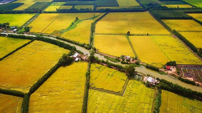
Vietnam: What types of land are included in the agricultural land group and the non-agricultural land group? (Internet image)
Regarding this issue, LawNet would like to answer as follows:
1. What types of land are included in the agricultural land group and the non-agricultural land group?
According to Clauses 1 and 2, Article 8 of Circular 27/2018/TT-BTNMT, the group of agricultural land and the group of non-agricultural land include the following types of land:
* Group of agricultural land, including:
- Land for agricultural production, including land for growing annual crops and land for growing perennial crops.
The land for growing annual crops includes the following types: Land for rice cultivation (including land for specializing in wet rice cultivation, the remaining land for wet rice cultivation, and land for upland rice cultivation); land for planting other annual crops (including flat land for other annual crops and swidden land for other annual crops);
- Forestry land includes production forest land, protection forest land, and special-use forest land; including land with natural forests, land with planted forests, and land being used for forest protection and development;
- Aquaculture land;
- Salt-making land;
- Other agricultural land.
* Group of non-agricultural land, including:
- Residential land includes residential land in rural areas and residential land in urban areas;
- Land for construction of the agency's headquarters;
- Defense land;
- Security land;
- Land for construction of non-business works, including land for construction of headquarters of non-business organizations; land for construction of cultural facilities; land for construction of social service establishments; land for construction of medical facilities; land for construction of education and training institutions; land for construction of physical training and sports facilities; land for construction of science and technology bases; land for construction of diplomatic establishments; and land for construction of other non-business works;
- Non-agricultural production and business land, including industrial park land; industrial cluster land; land for export processing zones; commercial and service land; land for non-agricultural production establishments; land used for mineral activities; land for the production of building materials and pottery;
- Land used for public purposes, including land for traffic; irrigation land; land with historical - cultural relics; scenic land; community land; land for public amusement and entertainment areas; land for energy works; land for post and telecommunications works; market land; land for landfill and waste treatment; land for other public works;
- Land for religious establishments;
- Land for belief establishments;
- Land for cemeteries, graveyards, funeral homes, and crematoriums;
- Land of rivers, streams, canals, and streams;
- Land with a specialized water surface;
- Other non-agricultural land.
2. Statistical norms, periodic land inventory by general area in Vietnam
The criteria for statistics and periodic land inventory by general area in Vietnam according to Article 10 of Circular 27/2018/TT-BTNMT are as follows:
- Land in rural residential areas: An inventory of all types of land in the area determined to be used mainly for housing construction, construction of public works in service of people's lives and activities; garden land, ponds attached to houses, and other types of land within the boundaries of rural residential areas within the administrative boundaries of communes, except for new urban areas in the case specified in Clause 5, Article 10 of Circular 27/2018/TT-BTNMT.
The boundary of a rural residential area is determined according to the land use planning or construction planning of rural residential areas already approved by the competent authority; in case a rural residential area has no approved planning, it shall be determined according to the boundary of the land plot with the outermost houses of the existing hamlet, village, phum, squirrel, and similar residential areas.
For the case of population living along canals, ditches, and roads, or individuals living separately in places where there is no planning or outside the scope of the approved rural residential area planning, only statistics on the area of the land plot with houses and gardens and ponds attached to the houses;
In case the boundary of residential land and associated gardens and ponds cannot be determined, only the recognized residential land area shall be enumerated, in case the land plot has not been granted a certificate of land use right, the residential land area shall be temporarily determined equal to the new residential land allocation quota set by the provincial-level People's Committee.
- Land of high-tech zone: To inventory all types of land in hi-tech parks established under the Prime Minister's decision to use for the purposes of production and trading of high-tech products, research and development, applying high technology, and training high-tech human resources.
- Economic zone land: To inventory all types of land in economic zones and border-gate economic zones established under the Prime Minister's decision that has been allocated land by a competent state agency to the economic zone management board for management and re-allocation, leased land for the purpose of building non-tariff zones, tax reporting zones, export processing zones, etc. , industrial parks, entertainment zones, tourist areas, urban areas, residential areas, administrative areas and other functional areas suitable to the characteristics of each economic zone.
- Land for hi-tech agricultural zones: Inventory of areas and projects using land for agricultural production that apply new and advanced technologies, including: industrialization (mechanization), automation of production processes;
Applying information technology and biotechnology to breeding, production, preservation, and processing of agricultural products with high economic efficiency per unit area and sustainable development
based on organic farming.
- Urban land: To make statistics and an inventory of land types within the administrative boundaries of wards and townships; new urban areas have been formed in fact within the scope of development plannings of districts, towns, and provincial cities already approved by competent agencies.
- Land for nature reserves: An inventory of land for nature reserves (including national parks, nature reserves, species and habitat conservation areas, and landscape protection areas) has been established according to the decision of the Prime Minister, the President of the People's Committee of the province.
- Land for biodiversity conservation facilities: To inventory the land of facilities that care for, nurture, rescue, and breed wild species, plants, livestock, endemic and valuable microorganisms, and fungi; store and preserve genetic resources and genetic specimens for the purpose of biodiversity conservation and development.
Wetlands: Inventory of wetlands, peatlands, and other permanent or seasonal wetlands; including sea areas with a depth of not more than 6 meters at the lowest tide, being used for agricultural, non-agricultural, and nature conservation purposes.
- Key word:
- agricultural land
- in Vietnam
- Cases of land rent exemption and reduction under the latest regulations in Vietnam
- Economic infrastructure and social infrastructure system in Thu Duc City, Ho Chi Minh City
- Regulations on ordination with foreign elements in religious organizations in Vietnam
- Increase land compensation prices in Vietnam from January 1, 2026
- Determination of land compensation levels for damage during land requisition process in Vietnam
- Who is permitted to purchase social housing according to latest regulations in Vietnam?
-

- Emergency response and search and rescue organizations ...
- 10:29, 11/09/2024
-

- Handling of the acceptance results of ministerial ...
- 09:30, 11/09/2024
-

- Guidance on unexploded ordnance investigation ...
- 18:30, 09/09/2024
-

- Sources of the National database on construction ...
- 16:37, 09/09/2024
-

- General regulations on the implementation of administrative ...
- 11:30, 09/09/2024
-

- Notable new policies of Vietnam effective as of ...
- 16:26, 11/04/2025
-
.Medium.png)
- Notable documents of Vietnam in the previous week ...
- 16:21, 11/04/2025
-
.Medium.png)
- Notable documents of Vietnam in the previous week ...
- 16:11, 02/04/2025
-
.Medium.png)
- Notable new policies of Vietnam to be effective ...
- 16:04, 02/04/2025
-
.Medium.png)
- Notable new policies of Vietnam effective from ...
- 14:51, 21/03/2025

 Article table of contents
