Regulations on storage and presentation of data on land surveying, assessment and land conservation and restoration in Vietnam
The following are regulations on storage and presentation of data on land surveying, assessment and land conservation and restoration in Vietnam

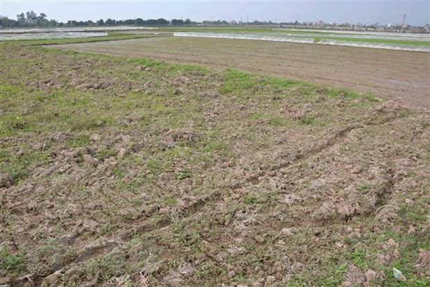
Regulations on storage and presentation of data on land surveying, assessment and land conservation and restoration in Vietnam (Internet image)
1. Regulations on storage and presentation of data on land surveying, assessment and land conservation and restoration in Vietnam
Regulations on storage and presentation ofland surveying, assessment and land conservation and restoration in Vietnam according to Article 7 of Circular 11/2024/TT-BTNMT are as follows:
* Stored Data
- Stored data includes: spatial data, attribute data of the survey network point diagram, sampling points, survey points; information layers of the land survey and assessment map results; results of land protection, restoration, and rehabilitation; information layers of the map results of land protection, restoration, and rehabilitation; and other relevant data (field survey results; summary reports; system of results tables of land survey and assessment; protection, restoration, and rehabilitation of land);
- Content of stored land survey and assessment data; stored data for land protection, restoration, and rehabilitation as specified in Table 04/QDC of Appendix I issued with Circular 11/2024/TT-BTNMT.
* Stored Data Format
- Data is stored in digital form;
- Stored data files are in one of the following formats: *.pdf, *.docx, *.xlsx, *.shp, *.gdb, *.qdb, *.xml, *.gml, *.json, *.geojson. The file must be in an open format, allowing for editing and updating information as necessary, ensuring data integrity during format and structure conversion;
- Structure and type of stored data information according to the regulations in Part D of Appendix II, Part D of Appendix III, Part D of Appendix IV, Part D of Appendix V, and Table 05/BVD of Appendix VI issued with Circular 11/2024/TT-BTNMT.
* Presented Data
- Presented data is organized according to information layers, fully expressing attributes of land plots, where the boundaries of land plots under the same index system are identified in the same information map layer;
- Data presentation files of land survey and assessment results; presented data files for land protection, restoration, and rehabilitation in one of the following formats: *.wor, *.mxd, *.mpk, *.qgz.
2. Regulations on the development of tasks of land surveying, assessment and land conservation and restoration in Vietnam
Regulations on the development of tasks for land survey and assessment; tasks for protection, restoration, and rehabilitation of land according to Article 8 of Circular 11/2024/TT-BTNMT are as follows:
* Collecting documents for task development
- Collect documents, data, maps related to the development of tasks;
- Collect programs, projects, and research topics previously related to the tasks.
* Defining the objectives and tasks of the assignment.
* Identifying the location, scale of the area, survey subjects, and maps to be used in the task.
* Evaluating the quality, timeliness, and reliability of the collected documents, data, and maps; selecting the collected documents for task development.
* Defining content, volume, implementation methods, and task products, including:
- Defining content and volume of each work step;
- Determining methods, technical measures, and socioeconomic solutions;
- Defining task products and completion time;
- Determining implementation time, investors, and task managers.
* Developing cost estimates according to the content and volume of work, including:
- Defining the basis for cost estimation;
- Determining the total cost estimate of the task;
- Determining detailed cost estimates for each work item of the task.
* Finalizing the land survey and assessment tasks; tasks for land protection, restoration, and rehabilitation for approval by the competent authority.
- Cases of land rent exemption and reduction under the latest regulations in Vietnam
- Economic infrastructure and social infrastructure system in Thu Duc City, Ho Chi Minh City
- Regulations on ordination with foreign elements in religious organizations in Vietnam
- Increase land compensation prices in Vietnam from January 1, 2026
- Determination of land compensation levels for damage during land requisition process in Vietnam
- Who is permitted to purchase social housing according to latest regulations in Vietnam?
-

- Number of deputy directors of departments in Vietnam ...
- 15:04, 05/03/2025
-

- Cases ineligible for pardon in Vietnam in 2025
- 14:43, 05/03/2025
-

- Decree 50/2025 amending Decree 151/2017 on the ...
- 12:00, 05/03/2025
-

- Circular 07/2025 amending Circular 02/2022 on ...
- 11:30, 05/03/2025
-

- Adjustment to the organizational structure of ...
- 10:34, 05/03/2025
-

- Notable new policies of Vietnam effective as of ...
- 16:26, 11/04/2025
-
.Medium.png)
- Notable documents of Vietnam in the previous week ...
- 16:21, 11/04/2025
-
.Medium.png)
- Notable documents of Vietnam in the previous week ...
- 16:11, 02/04/2025
-
.Medium.png)
- Notable new policies of Vietnam to be effective ...
- 16:04, 02/04/2025
-
.Medium.png)
- Notable new policies of Vietnam effective from ...
- 14:51, 21/03/2025

 Article table of contents
