Data group on land use right, land management right in Vietnam

What is included in the data group on land use right, land management right in Vietnam? - My Dung (Tien Giang)
 Article table of contents
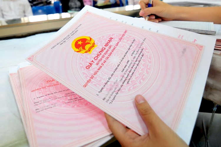
Data group on land use right, land management right in Vietnam (Internet image)
Regarding this issue, LawNet would like to answer as follows:
1. Data group on land use right, land management right in Vietnam
According to Article 16 of Circular 24/2014/TT-BTNMT, data group on land use right shall include data which can be defined and shown as follows:
- Data on forms of private land use, common land use shall be shown as follows:
= Form of private land use shall be shown in the land plot is under the right to use of a land user (an individual or a household, a community, a domestic organization, a religious institution, a foreign individual, a foreign organization, an oversea Vietnamese), including common rights to use land of husband and wife;
= Form of common land use shall be shown in case the land plot is under the right to use of many land users (many individuals who are not in the same household or many households or many couples or many organizations or all of individuals, households, organizations);
= If the land plot has the area under the common use of many land users and the area under private use of each land user, each part of the common use area and names of users shall be determined and shown ; each part of the private use area and the name of the persons who have right to use land shall be recorded.
- Data on land category including land name and code (symbol) shall be shown in accordance with the following provisions:
= Land category shall be determined and shown by the name in cadastral books and code in cadastral maps and land-itemizing books for each land plot, trespassed land ;
= Category of land shall be shown in cadastral books under the use purpose of land allocated, leased, recognized the right to use, allowed to change the land use purpose or assigned to manage by the State . If the land is registered the first time but has not certified its land use right by the State, category of land under the current conditions of use at the time of registration shall be determined and shown Categories of land shown shall include:
== Agricultural land, including land of the following categories: rice-farming land; one-crop-a-year rice-farming land, upland rice land; land for cultivation of annual crops; land for growing perennial trees; production forest land; protective forest land; special-use forest land; aquaculture land; salt-making land; other agricultural land
== Non-agricultural land, including land of the following categories: rural residential land ,urban residential land; land for construction of offices; defense and/or security land; land for construction of offices of non-business facilities; land for construction of cultural facilities; land for construction of medical facilities; land for construction of educational and training facilities;
Land for construction of sport and physical facilities; land for construction of science and technology facilities; land for construction of social service facilities; land for construction of diplomatic facilities; land for construction of other non-business facilities; industrial zone land; industrial complex land; processing and exporting zone land;
Commercial and service land; land for construction of non-agricultural production facilities; land for mineral operation ; land for production of building materials and pottery-making; land for transportation; land for irrigation ;land with historical and cultural relics;land with scenic places;land for community operation;
Land for amusement and public recreation parks; land for energy construction ;land for post and telecommunication construction; market land; land for disposal sites, waste treatment;land for other public construction; land for religious establishment; land for belief establishment;
Land for cemeteries, grave-yards or land for cemeteries, grave-yards, crematory or land for crematory or land for funeral parlors; river, arryo, canal, trench, stream and special-use water surface land; other non-agricultural land
== Group of unused land shall be shown for the case of registered land allocated to manage by the State, including: unused Land; Unused hills; rock without forest;
= If the land categories according to current conditions is different from the land categories according to use purpose allocated, leased, recognized the land use rights, allowed to change the land use purpose or assigned to manage by the State, the land categories according to current conditions and the land allocated, leased, recognized the land use rights, allowed to change the land use purpose or assigned to manage by the State shall be recorded in the land-itemizing books and cadastral maps;
= Land category code shown in land-itemizing books and cadastral maps shall be complied with provisions on cadastral maps and be explained in accordance with land statistics and inventory of the Ministry of Natural Resources and Environment ;
= If the land plot is allocated , leased, recognized the land use rights by the State simultaneously in many different purposes without distinguishing between the purposes, all purposes shall be shown . If the land plot is used for multiple purposes which include main and additives purposes, the word"(main)" or "(additional)" shall be recorded after each purpose. Example: "Rice-farming land (main); aquaculture land (additional)".
The land plot with pond garden attached with house in residential areas without being recognized the whole land plot as residential land, the area shall be determined according to each purpose: Residential land and agricultural land according to the use current conditions( annual crop land or land for perennial perennial crops, aquaculture land).
- The data on land use term shall be shown as follows:
= The data on land use term shall be determined and shown in agreement with the certificate;
= Where the term land is uses, the following information shall be shown : Date of expiration of land use;
= If the land is in use of long-term stability, the words: "Long-term" shall be shown ;
= If the land plot is allocated , leased, recognized the land use rights by the State simultaneously in many different purposes each of which has a different term, the use term corresponding to each purpose shall be shown;.
= If the land plot has gardens, ponds attached with houses in residential areas and the area of residential land recognized is smaller than that of the land plot, land use term for the residential land is "long-term"; the use term for gardens and ponds unrecognized as residential land shall be determined as stipulated by the Law on Land for agricultural land which is being used;
= If the land is registered but the Certificate is not requested to be granted but there are papers on land use rights, land use term shall be determined and recorded according to that papers; if there are no papers or there are papers on land use rights but the term has not been determined, the word "undetermined" shall be shown.
If the land is registered without eligibility for granting the Certificate, the words "Temporary use" shall be used;
= If the land plot has many area parts with different land use term, the use term corresponding to each that part of area shall be determined and shown;
= If the land assigned to be managed by the State is registered, the written assignment of management shall be based to show; if there is no written assignment of land management or there is no term in the written assignment of land management, the word "Undetermined" shall be shown.
- Data on origin of land use shall be determined and shown in the names and codes in accordance with the following provisions:
= In case the State allocates land without collecting land levy, the name : “the State allocates land without collecting land levy’’ and the code "DG-KTT" shall be shown;
= In case the State allocates land with collection of land levies (including cases of allocation through auction of land use rights, in case of purchase of apartment of investors allocated land with collection of land levies and re-allocation of land by the management board of hi-tech zones, economic zones ), the name "the State allocates land with collection of land levies" and the code "DG-CTT" shall be shown;
= In case the State lease the land with lump-sum payment (including cases of land lease through auction of land use rights or being recognized the land use right by the State in the form of land lease and being leased the land with lump-sum payment by the management board of hi-tech zones, economic zones), the name "the State lease the land with lump-sum payment" and the code "DT-TML’’ shall be shown;
= In case the State lease the land with annual payment (including cases of land lease through auction of land use rights or being recognized the land use right by the State in the form of land lease and being leased the land with annual payment by the management board of hi-tech zones, economic zones), the name "the State lease the land with annual payment" and the code "DT-THN’’ shall be shown;
= In case the State recognizes the land use right under regulations of allocation with collecting land levy( including that households and individuals use residential land, non-agricultural business, production land without payment of land levy when being granted the Certificate), the name "Recognition of rights of land allocation with collection of land levy" and the code "CNQ-CTT" shall be shown;
= In case the State recognizes the land use right under the regulations of land allocation without collocating land levy, the name "Recognition of rights of land allocation without collection of land levy" and the code "CNQ-KTT" shall be shown;
= In case the land plot id divided, consolidate or the Certificate is replaced or reissued of origin , the use origin of land as registered and granted the Certificate for the first time shall be shown under Points a, b , c, d, dd and f of this paragraph.
In case the land is registered, the certificate is granted but the use origin is not shown, the application for granting the Certificate and provisions of legislation on land at the time of registration of changes , replacement and reissuance of the Certificates shall be based on to determine and show the use origin of land under the provisions of Circular 24/2014/TT-BTNMT
= In case the land use rights are received from transfer, the transfer form shall be shown (in case of receipt of change, transfer or inheritance or donation, capital contributions) or the words "receipt of right transfer " and its basis shall be shown (in case of winning the auction, mortgage settlement, dispute resolution and settlement of complaints or denunciations, implementation of the decision or judgment of the People's Court, implementation of enforcement decisions, ...);
The use origin of land as on the granted Certificate for the first time shall be shown next under the provisions of Circular 24/2014/TT-BTNMT. Cases of receipt of transfer shall be shown in a common code "NCQ" with the source code as on the certificate granted the first time.
Example: " Receipt of transfer of land allocated without collection of land levy by the State (NCQ-DG-KTT)"; "Receipt of transfer due to dispute settlement of land allocated without collection of land levy by the State (NCQ-DG-CTT)".
In case land use right is received from transfer to be used for other purposes and procedures for transfer of land use purpose are carried out, the origin of land use in the form of implementation of financial obligations to the State after the purpose of land use is changed shall be shown;
= In case the land use purpose is changed and the land levy is paid, showing shall comply with provisions for cases the State allocates the land with collection of land levy;
In case the land use purpose is changed and the land levy is paid, showing shall comply with provisions for cases the State leases the land; in case the land use purpose is changed and the land levy is not paid and is not changed the land lease showing shall be as registered, granted the Certificate before the land use purpose is changed;
= In case the land is leased or subleased with lump-sum payment of the investor of infrastructure construction in industrial zones, industrial complexes, processing and exporting zones, hi-tech zones and economic zones, the words "Land lease of industrial zones( or industrial complexes, processing and exporting zones…) with lump-sum payment” and the code" DT-IZ-TML " shall be shown.
In case the land is leased or subleased with annual payment of the investor of infrastructure construction in industrial zones, industrial complexes, processing and exporting zones, hi-tech zones and economic zones, the words "Land lease of industrial zones( or industrial complexes, processing and exporting zones…) with annual payment” and the code" DT-KCN-THN " shall be shown.
= If the land plot has many area parts with different land use origins, each origin and the land under such origin shall be shown;
= In case the land which is being used and its user does not have legal papers on the origin of land use and has no need of the Certificate or is ineligible for the Certificate is registered , the origin according to actual use including the following information: The start time of using the land for registered purposes and land use reasons.
For example: "Use of land since 1984, due to self-exploitation (left by his father, transferred, allocated by the State without land levy)";
= In case land allocated by the State to manage is registered the words "State allocates to manage" and the code "DG-QL" shall be shown.
- Data on financial obligations shall be shown as follows:
= Data on financial obligations for payable financial obligations shall include land levy, land rents, income tax from land use right transfer, registration fees;
=The data content shall be shown as follows:
== If the financial obligations have been fulfilled, information including: type of payable financial obligations; payable amount, paid amount and payment date shall be shown. If the State leases land with annual payment, the words: “Annual land rent payment” shall be shown;
== If the financial obligations is exempted , the payable financial obligations , payable amount ( if determined) shall be shown; the words “ exempted from payment under the ... (Name and number, date and signing agenicies of the written exemption) shall be shown next;
== If the financial obligations is exempted , the unplayable financial obligations shall be shown ; the words “ under the provisions in ... (Name and number of the provisions) shall be shown next;
== If the financial obligations is reduced , the payable financial obligations , payable amount ; reduced amount (the % or years) and the legal basis (name and number, date and signing agencies of the written reduction of the financial obligations); paid amount ,paid date(except for payment of annual rent) shall be shown ;
= The contents of the data for case financial obligations are owned to the state shall include: Type of owned financial obligations ; owed amount (in figures and words) and legal documents to determine the owned amount (name, signing dated, signing competent authority) for the case determined by competent agencies in collecting financial obligations (if any).
Example: "Owning the land levy" or "Owning the land levy, amount: VND 200,000,000 (Two hundred million dong) under Notification No. 15 / TB-CCT date October 20, 2013 of Tax Department ".
If the owned amount has been forgiven in accordance with the law or under the decision of the competent authorities in collecting financial obligations, the forgiven financial obligations ; forgiven amount (if forgiving a portion of the debt); legal basis for forgiving (name and number, signing date, signing competent authority ) shall be shown.
If the land user has been paid the full owned amount, the type of fulfilled financial obligations; paid amount ; payment vouchers (name and number, signing date of payment vouchers). For example: "Having fully paid the owned land levy, paid amount : VND 200,000,000(two hundred million), according remittance bills No. 006523 dated May 23.1998"; shall be shown
= In case the land is registered without requested for granting certificates or ineligibility of granting the Certificate, the word “ undetermined” shall be shall
= In case the land allocated by the State to manage is registered, the word “ undetermined” shall be shown.
- Data on land use right restrictions shall be shown in the restricted land scope and content of land use right restrictions as follows:
= Data on land use right restrictions shall be shown in case of : the land plot in project safety corridor; in the decisions on land allocation , land lease and change of land use purpose or papers of receipt of the use right with restriction contents of land use rights compared with the provisions of law; land registration without being but is not recognized by the State of land use rights; Oversea Vietnamese inherited or donated of land use right, ownership of property on land but not entitled to own houses in Vietnam;
= The scope of restricted land of land use right must clearly indicate that the entire of land plot or a portion of it. In case of restriction of the use right on a portion of the land plot, in addition to the area of restriction land in the cadastral book, the location and boundaries of the land with restrictions on the map, land plot diagram shall be shown ;
= Restriction contents of land use right shall be shown as follows:
== In case of in the decisions on land allocation , land lease and change of land use purpose or papers of receipt of land use right with restriction content of land use right , the words: "land plot (or land plot with ... m² (if a part of the plot is restricted)) ... (write restrictions content under current documents) according to ... (name on document of restriction content) " shall be shown;
== In case the land plot or a portion of the land plot is in the project safety corridor, the words : "land plot (or land plot with ... m² (if a part of the plot is restricted)) in project safety corridor ... (name of the protect with the safety corridor) " shall be shown;
== If the land is registered without being recognized its land use right by the State ,the words : " the status quo of land use must be maintained until the State has decision to handle";
== If an individual or a couple or either of them (wife or husband) is oversea Vietnamese who is inherited or donated the land use right , ownership of property on land but not entitled to own houses in Vietnam and has not transferred the land use rights, ownership of property on land, when the land is registered for that person, the restrictions (name of person who is not entitled to own house ) “ oversea Vietnamese not entitled to own houses in Vietnam " must be shown;
== If the land plot does not have restrictions, showing shall be as follow :
- Data on restriction use right for the adjacent land plot shall be shown for both land plot enjoyed the restriction use right and land plot providing restriction use right as follows:
= The registration part of the land plot entitled to restriction use on another land plot, the words "being entitled to... (content of the restriction use rights) on land plot number ... under ... (name of the document establishing the restriction use right) date ... / ... / .. " shall be shown;
= The registration part of the land plot restricted the use rights, the words "allowing the user of the land plot number...to…. (content of the restriction use rights) on land plot number ...(number of the land plot of the party restricted the use right) under ... (name of the document establishing the restriction use right) date ... / ... / .. " shall be shown;
= If there is a restriction on a portion of the land plot, in addition to restriction content on the cadastral book land the location, the area entitled to restriction on the map , land plot diagram shall be shown;
= If the land plot does not have restrictions for the adjacent land plot, the sign: "- / -" shall be shown;
2. Principles of complication, update, readjustment of cadastral dossiers in Vietnam
Principles of complication, update, readjustment of cadastral dossiers in Vietnam according to Article 5 of Circular 24/2014/TT-BTNMT are as follows:
- Cadastral dossiers shall be compiled for each administrative unit of communes, wards and towns.
- Compilation, update, readjustment of cadastral dossiers must comply with administrative procedures as prescribed by legislation of land.
- The contents of the information in cadastral dossiers must ensure the consistency with the granted Certificate (if any) and conformity with current conditions of land management and use.
- Key word:
- land use right
- in Vietnam
- land management right
- Cases of land rent exemption and reduction under the latest regulations in Vietnam
- Economic infrastructure and social infrastructure system in Thu Duc City, Ho Chi Minh City
- Regulations on ordination with foreign elements in religious organizations in Vietnam
- Increase land compensation prices in Vietnam from January 1, 2026
- Determination of land compensation levels for damage during land requisition process in Vietnam
- Who is permitted to purchase social housing according to latest regulations in Vietnam?
-
- The Prime Minister of Vietnam requests regulation ...
- 16:40, 18/12/2024
-

- The Prime Minister of Vietnam requests prompt ...
- 15:30, 16/12/2024
-
- Emergency response and search and rescue organizations ...
- 10:29, 11/09/2024
-

- Handling of the acceptance results of ministerial ...
- 09:30, 11/09/2024
-
- Guidance on unexploded ordnance investigation ...
- 18:30, 09/09/2024
-

- Notable new policies of Vietnam effective as of ...
- 16:26, 11/04/2025
-
.Medium.png)
- Notable documents of Vietnam in the previous week ...
- 16:21, 11/04/2025
-
.Medium.png)
- Notable documents of Vietnam in the previous week ...
- 16:11, 02/04/2025
-
.Medium.png)
- Notable new policies of Vietnam to be effective ...
- 16:04, 02/04/2025
-
.Medium.png)
- Notable new policies of Vietnam effective from ...
- 14:51, 21/03/2025
