Contents of database of national geographic and national topographic map in Vietnam
What are the contents of database of national geographic and national topographic map in Vietnam? - Khanh Linh (Tien Giang)

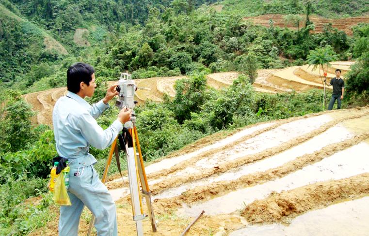
Contents of database of national geographic and national topographic map in Vietnam (Internet image)
Regarding this issue, LawNet would like to answer as follows:
1. Contents of database of national geographic and national topographic map in Vietnam
According to Article 10 of Decree 27/2019/ND-CP, the contents of the database of national geographic and national topographic map include:
- The national geographic database is a collection of geographic base data constructed in the national coordinate system and national height system according to national standards and technical regulations for unified use nationally, including the following component data:
+ Base measurement data is data about coordinate points and altitudes used in the process of measuring, acquiring, and processing geographical data;
+ Terrain data is elevation and depth data that describes the shape and characteristics of the Earth's surface, including elevation points, depth points, contour lines connecting points with the same elevation value, lines describing terrain characteristics, and special terrain types;
+ Hydrological data is data about river systems, streams, canals, ditches, seas, lakes, ponds, lagoons, water sources, water shorelines, and other hydrological objects;
+ Population data is data about residential areas and residential-related works, including urban residential areas, rural residential areas, industrial parks, special function areas, other residential areas, civil works, and other economic, cultural, and social facilities;
+ Traffic data is data about traffic networks and traffic-related works, including road systems, railways, airways, waterways, bridges, traffic tunnels, ports, buildings, stations, and other traffic works;
+ National border data and administrative boundaries include national border data and administrative boundary data.
National border data is data about national borders and the system of national landmarks; base points, baselines used to calculate the width of Vietnam's territorial sea, national border features, and geographical objects related to the representation of national borders on land and at sea.
Administrative boundary data is data on administrative boundary lines at all levels and the system of administrative boundary markers; data on geographical objects related to the representation of administrative boundaries at all levels;
+ Surface cover data is data about the current cover status of the Earth's surface, including vegetation cover, land use layer, water surface layer, and other cover layers.
- A large-scale national geographic database is established from the results of measurements, surveys, and information acquisition of geographical objects; the medium-scale and small-scale national geographic databases are established from the larger-scale national geographic database.
- National topographic map is established from the national geographic database according to national standards, technical regulations, and technical regulations on topographic maps. The content of the national topographic map is divided into the following data layer groups:
+ Basic Mathematics class group includes content on the map projection grid, plot designation, map scale, coordinate grid, coordinate points and elevation points within the map plot, and presentation contents outside the map plot;
+ Terrain data layer group;
+ Hydrological data layer group;
+ Population data layer group;
+ Traffic data layer group;
+ National border and administrative boundaries data layer group;
+ Vegetation cover data layer group.
- The data layer groups specified in Points b, c, d, dd, e, and g, Clause 3, Article 10 of Decree 27/2019/ND-CP, are established from the corresponding geographical data at Points b, c, d, dd, e, and point g of Clause 1 of Article 10 of Decree 27/2019/ND-CP.
2. Regulations on updating databases of national geographic and national topographic maps in Vietnam
Updating the database of national geographic and national topographic maps according to Article 11 of Decree 27/2019/ND-CP is as follows:
*Requires update
The database of national geographic and national topographic maps must be fully and accurately updated according to standards, national technical regulations, and technical regulations to promptly ensure state management requirements of ministries, branches, and localities, serving economic and social development, national defense, security, and natural disaster prevention.
* The update method is as follows:
- Updating the national geographic database at scales of 1:2,000 and 1:5,000 is carried out through adjusting and supplementing fluctuating geographical objects using measurement and mapping methods;
- Updating the national geographic database at a scale of 1:10,000 and smaller scales is done by editing updated fluctuating objects from the geographic background database at a larger scale, a new version; through adjusting and supplementing fluctuating geographical objects using measurement and mapping methods;
- Depending on the level of fluctuation, updating the national geographic database is carried out by each component, group of component data, or region. In the event that more than 40% of geographic objects in the region change, a new national geographic database will be established for the entire region;
- When the national geographic database is updated, the corresponding scale national topographic map is updated simultaneously.
* Updated content includes:
- For the national geographic database, the updated content includes supplementing and correcting changes in spatial location and attributes of geographical objects in component data prescribed in Points b, c, d, dd, e and g, Clause 1, Article 10 of Decree 27/2019/ND-CP;
+ For the national topographic map, the updated content includes the addition and correction of fluctuating geographical objects belonging to the map content layer groups specified in Clause 3 of Article 10 of Decree 27/2019/ND-CP.
* The national geographic database update cycle is the maximum time between two data updates according to the following regulations:
- Within no more than 05 years, the national geographic database must be periodically updated. For the national geographic database of medium and small scales in Vietnam's sea areas, it is updated periodically for no more than 07 years;
- Traffic data and population data are updated annually;
- During the update cycle, in case the component data fluctuates greater than 20%, update that component data;
- Immediate updates to national border data and administrative boundaries are made when there are changes;
- Immediate updates in areas with unusual changes to serve natural disaster prevention and control, rescue, environmental incident recovery, and response to climate change;
- Immediate updates to the area at the request of the competent state agency.
- Cases of land rent exemption and reduction under the latest regulations in Vietnam
- Economic infrastructure and social infrastructure system in Thu Duc City, Ho Chi Minh City
- Regulations on ordination with foreign elements in religious organizations in Vietnam
- Increase land compensation prices in Vietnam from January 1, 2026
- Determination of land compensation levels for damage during land requisition process in Vietnam
- Who is permitted to purchase social housing according to latest regulations in Vietnam?
-

- Emergency response and search and rescue organizations ...
- 10:29, 11/09/2024
-

- Handling of the acceptance results of ministerial ...
- 09:30, 11/09/2024
-

- Guidance on unexploded ordnance investigation ...
- 18:30, 09/09/2024
-

- Sources of the National database on construction ...
- 16:37, 09/09/2024
-

- General regulations on the implementation of administrative ...
- 11:30, 09/09/2024
-

- Notable new policies of Vietnam effective as of ...
- 16:26, 11/04/2025
-
.Medium.png)
- Notable documents of Vietnam in the previous week ...
- 16:21, 11/04/2025
-
.Medium.png)
- Notable documents of Vietnam in the previous week ...
- 16:11, 02/04/2025
-
.Medium.png)
- Notable new policies of Vietnam to be effective ...
- 16:04, 02/04/2025
-
.Medium.png)
- Notable new policies of Vietnam effective from ...
- 14:51, 21/03/2025

 Article table of contents
