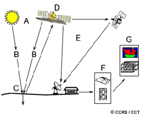
What are the tasks involved in remote sensing image production?
Circular 10/2015/TT-BTNMT stipulates technical regulations on the production of high and ultra-high resolution optical remote sensing images for supply to users, issued by the Minister of Natural Resources and Environment on March 25, 2015.

Content of remote sensing image production activities (Illustrative image)
Circular 10/2015/TT-BTNMT stipulates the contents of high and ultra-high resolution optical remote sensing image production activities, including:
- Preparation work: collecting data and other related technical documents.- Data input: entering remote sensing image data, map data, digital elevation model data, and related data into the remote sensing image processing system.- Production of 1A remote sensing images: using the collected data to produce 1A remote sensing images and then checking the quality of the product.- Production of 2A remote sensing images: using the collected data to produce 2A remote sensing images and then checking the quality of the product.- Production of 3A remote sensing images: using the collected data to produce 3A remote sensing images and then checking the quality of the product.- Production of 3B remote sensing images: using the collected data to produce 3B remote sensing images and then checking the quality of the product.- Packaging and delivering the product.
The process flowchart for remote sensing image production is stipulated as follows:

For details, see Circular 10/2015/TT-BTNMT, effective from May 12, 2015
Le Hai
- Number of deputy directors of departments in Vietnam in accordance with Decree 45/2025/ND-CP
- Cases ineligible for pardon in Vietnam in 2025
- Decree 50/2025 amending Decree 151/2017 on the management of public assets in Vietnam
- Circular 07/2025 amending Circular 02/2022 on the Law on Environmental Protection in Vietnam
- Adjustment to the organizational structure of the Ministry of Health of Vietnam: Certain agencies are no longer listed in the organizational structure
- Vietnam aims to welcome 22-23 million international tourists in Vietnam in 2025
-

- Notable new policies of Vietnam effective as of ...
- 16:26, 11/04/2025
-
.Medium.png)
- Notable documents of Vietnam in the previous week ...
- 16:21, 11/04/2025
-
.Medium.png)
- Notable documents of Vietnam in the previous week ...
- 16:11, 02/04/2025
-
.Medium.png)
- Notable new policies of Vietnam to be effective ...
- 16:04, 02/04/2025
-
.Medium.png)
- Notable new policies of Vietnam effective from ...
- 14:51, 21/03/2025
 Article table of contents
