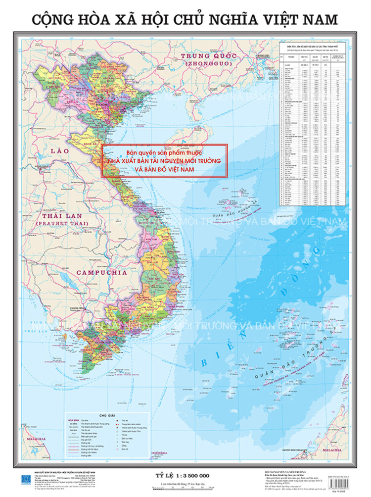
Vietnam: Types of administrative maps of all levels under Circular 47
This is one of the important contents stipulated in Circular 47/2014/TT-BTNMT on technical regulations on administrative maps of all levels in Vietnam, promulgated on August 22, 2014.

According to Article 4 of Circular 47/2014/TT-BTNMT, the types of administrative maps of all levels in Vietnam are as follows:
- Nationwide administrative maps are maps indicating the separation and management of provinces in Vietnamese territory including mainland, sea, island, and archipelagos.
- Administrative maps of provinces and central-affiliated cities (hereinafter referred to as “provincial administrative maps”) are maps indicating the separation and management of districts in a province or central-affiliated city.
- Administrative maps of districts, district-level cities (hereinafter referred to as “district administrative maps”) are maps indicating the separation and management of communes in a district, district-level city.
- Nationwide administrative atlases are atlases that consist of provincial administrative maps of the same size in Vietnamese territory.
- Provincial administrative atlases are atlases that consist of district administrative maps of the same size in provinces.
- District administrative atlases are atlases that consist of commune administrative maps of the same size in districts.
Governmental administrative map consists of nationwide administrative maps of a minimum ratio of 1:3.500.000; provincial-level, district-level, other administrative level maps in territory atlas that fit page size of A3 or larger.
More details can be found in Circular 47/2014/TT-BTNMT effective from August 22, 2014.
Thuy Tram
- Number of deputy directors of departments in Vietnam in accordance with Decree 45/2025/ND-CP
- Cases ineligible for pardon in Vietnam in 2025
- Decree 50/2025 amending Decree 151/2017 on the management of public assets in Vietnam
- Circular 07/2025 amending Circular 02/2022 on the Law on Environmental Protection in Vietnam
- Adjustment to the organizational structure of the Ministry of Health of Vietnam: Certain agencies are no longer listed in the organizational structure
- Vietnam aims to welcome 22-23 million international tourists in Vietnam in 2025
-

- Number of deputy directors of departments in Vietnam ...
- 15:04, 05/03/2025
-

- Cases ineligible for pardon in Vietnam in 2025
- 14:43, 05/03/2025
-

- Decree 50/2025 amending Decree 151/2017 on the ...
- 12:00, 05/03/2025
-

- Circular 07/2025 amending Circular 02/2022 on ...
- 11:30, 05/03/2025
-

- Adjustment to the organizational structure of ...
- 10:34, 05/03/2025
-

- Notable new policies of Vietnam effective as of ...
- 16:26, 11/04/2025
-
.Medium.png)
- Notable documents of Vietnam in the previous week ...
- 16:21, 11/04/2025
-
.Medium.png)
- Notable documents of Vietnam in the previous week ...
- 16:11, 02/04/2025
-
.Medium.png)
- Notable new policies of Vietnam to be effective ...
- 16:04, 02/04/2025
-
.Medium.png)
- Notable new policies of Vietnam effective from ...
- 14:51, 21/03/2025
 Article table of contents
