Vietnam: Fundamental topographic and cartographic activities include standardizing place names
This is a notable content of the Law on Topography and Cartography 2018, approved by the National Assembly XIV of Vietnam at its 5th session on June 14, 2018.
- Vietnam: Exchanging topographic and cartographic information, data and products in international cooperation / 05 fundamental rules of topographic and cartographic activities in Vietnam
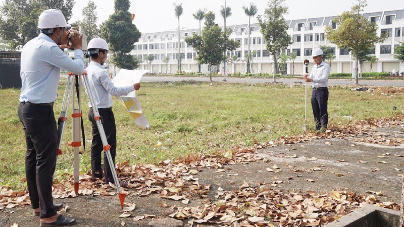
Specifically, according to Article 10 of the Law on Topography and Cartography 2018 of Vietnam, fundamental topographic and cartographic matters include:
- Establishing national original topographic data system, national coordinate system, national elevation system and national gravity system
- Establishing a data system of national topographic nets
- Establishing aerial photo data system and remote sensing photo data system
- Establishing, operating and updating national geographical background database, establishing and updating national topographic map system
- Surveying and mapping national boundaries
- Surveying and mapping administrative boundaries
- Standardizing place names
- Establishing and operating fundamental topographic infrastructure works
Besides, this Law also prescribes national original topographic data system, national coordinate system, national elevation system and national gravity system as follows:
- National original topographic data system includes original data on national coordinate system, national elevation system, national gravity system and national depth that are uniformly determined nationwide in accordance with national technical regulations. Each national original topographic data is attached to a point with a fixed and permanent marker called national original topographic point.
- National coordinate system, national elevation system, national gravity system and national depth are used to present the results of topography and cartography within territory of the Socialist Republic of Vietnam.
- The world coordinate system shall be used in accordance with provisions in international agreements to which the Socialist Republic of Vietnam is a signatory.
- The Ministry of Natural Resources and Environment of Vietnam shall develop and submit national original topographic data system, national coordinate system, national elevation system and national gravity system to be used uniformly nationwide to the Prime Minister for publication, establish and publish converting parameters between national coordinate system and the world coordinate system.
View more details at the Law on Topography and Cartography 2018 of Vietnam, effective from January 01, 2019.
Ty Na
- Key word:
- Law on Topography and Cartography 2018
- Number of deputy directors of departments in Vietnam in accordance with Decree 45/2025/ND-CP
- Cases ineligible for pardon in Vietnam in 2025
- Decree 50/2025 amending Decree 151/2017 on the management of public assets in Vietnam
- Circular 07/2025 amending Circular 02/2022 on the Law on Environmental Protection in Vietnam
- Adjustment to the organizational structure of the Ministry of Health of Vietnam: Certain agencies are no longer listed in the organizational structure
- Vietnam aims to welcome 22-23 million international tourists in Vietnam in 2025
-

- Information on organizations and individuals engaged ...
- 17:20, 25/06/2018
-

- Vietnam: Topography and cartography practicing ...
- 17:15, 25/06/2018
-

- Vietnam: A topography and cartography license ...
- 17:10, 25/06/2018
-

- 4 conditions for granting topography and cartography ...
- 17:10, 25/06/2018
-

- Vietnam: 05 contents of establishment of national ...
- 17:05, 25/06/2018
-

- Notable new policies of Vietnam effective as of ...
- 16:26, 11/04/2025
-
.Medium.png)
- Notable documents of Vietnam in the previous week ...
- 16:21, 11/04/2025
-
.Medium.png)
- Notable documents of Vietnam in the previous week ...
- 16:11, 02/04/2025
-
.Medium.png)
- Notable new policies of Vietnam to be effective ...
- 16:04, 02/04/2025
-
.Medium.png)
- Notable new policies of Vietnam effective from ...
- 14:51, 21/03/2025
 Article table of contents
