Vietnam: Economic-technical land statistical norms at district level applicable from September 23, 2019
Recently, the Ministry of Natural Resources and Environment of Vietnam signed to issue Circular 13/2019/TT-BTNMT, stipulating economic-technical norms for land statistics, inventory, and land use mapping.
Economic-technical land statistical norms at district level are issued under Circular 13/2019/TT-BTNMT of the Ministry of Natural Resources and Environment of Vietnam, specifically as follows:

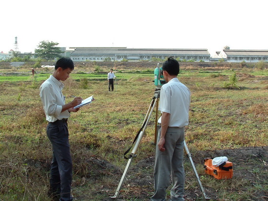
Illustration (source internet)
| No. | Work Content | Unit | Schedule | Norm Work/Output |
|---|---|---|---|---|
| 1 | Preparation Work | |||
| 1.1 | Document collection | File/district | 1KTV6 | 1.00 |
| 1.2 | Review and summarize parcels with changes in shape, land type, type of land user, and land management entity that have completed land administrative procedures within the statistical year from cadastral and relevant land procedure records, submitted to the commune People's Committee before November 15 for annual land statistics (excluding communes with land database utilized at the commune level): | |||
| 1.2.1 | Case where land database exists but not used at commune level | File/commune | 1KTV6 | 1.00 |
| 1.2.2 | Case where no land database exists | Parcel/district | 1KTV6 | 11.25 |
| 2 | Receive and tally submitted land statistics records from commune level | |||
| 2.1 | Receive completed land statistics records from commune level | File/district | 1KTV6 | 2.00 |
| 2.2 | Tally statistics results records from commune level | File/district | 1KS3 | 5.00 |
| 2.3 | Guide in revising, completing data, report on land statistics results | File/district | 1KS3 | 2.00 |
| 3 | District-level land statistics data compilation | |||
| 3.1 | Review and process statistical data from commune level for disputed, overlapping, or open administrative boundary areas | File/district | 2KS3 | 3.00 |
| 3.2 | Compile district-level land statistics data | File/district | 1KS3 | 2.00 |
| 3.3 | Review, compare information and data between tables, between paper and digital forms | File/district | 1KS3 | 1.00 |
| 4 | Data analysis, assessment of land use status, and local land change situation | |||
| 4.1 | Analyze and assess land use status and structure | File/district | 1KS3 | 3.00 |
| 4.2 | Analyze and assess land use changes | File/district | 1KS3 | 3.00 |
| 4.3 | Analyze and assess the implementation of the annual land use plan of the district | File/district | 1KS3 | 3.00 |
| 5 | Prepare district-level land statistics results report | File/district | 2KS3 | 5.00 |
| 6 | Finalize, submit, print and deliver the land statistics results report |
File/district | 1KTV6 | 2.00 |
Note:
(1) The norm in Table 2 above (excluding work at point 1.2) is for an average district (with 15 commune-level administrative units); when calculating the norm for specific districts, the actual number of commune-level units in the district is used in the following formula:
MH = Mtbh x [1 + 0.04 x (Kslx - 15)]
Where:
- MH is the labor norm for the district being calculated;
- Mtbh is the labor norm for an average district;
- Kslx is the number of commune-level units in the district.
(2) The norm at point 1.2.2 Table 2 is calculated for a district with an average of 450 parcels with changes in shape, land type, type of land user, and land management entity requiring annual statistics (15 communes x 30 parcels/commune) (when calculating the norm for a single parcel, divide the norm at point 1.2.2 by 450 parcels). For districts with a rate of change greater or less than 450 parcels, multiply the norm per parcel by the actual number of parcels.
Other provisions can be found in Circular 13/2019/TT-BTNMT of the Ministry of Natural Resources and Environment of Vietnam, effective from September 23, 2019.
Thu Ba
- Key word:
- Circular 13/2019/TT-BTNMT
- Number of deputy directors of departments in Vietnam in accordance with Decree 45/2025/ND-CP
- Cases ineligible for pardon in Vietnam in 2025
- Decree 50/2025 amending Decree 151/2017 on the management of public assets in Vietnam
- Circular 07/2025 amending Circular 02/2022 on the Law on Environmental Protection in Vietnam
- Adjustment to the organizational structure of the Ministry of Health of Vietnam: Certain agencies are no longer listed in the organizational structure
- Vietnam aims to welcome 22-23 million international tourists in Vietnam in 2025
-
.jpg)
- Vietnam's Circular 13: Issuing provincial-level ...
- 01:23, 10/07/2024
-

- Vietnam: Determining the economic-technical statistical ...
- 01:22, 10/07/2024
-

- Notable new policies of Vietnam effective as of ...
- 16:26, 11/04/2025
-
.Medium.png)
- Notable documents of Vietnam in the previous week ...
- 16:21, 11/04/2025
-
.Medium.png)
- Notable documents of Vietnam in the previous week ...
- 16:11, 02/04/2025
-
.Medium.png)
- Notable new policies of Vietnam to be effective ...
- 16:04, 02/04/2025
-
.Medium.png)
- Notable new policies of Vietnam effective from ...
- 14:51, 21/03/2025
 Article table of contents
