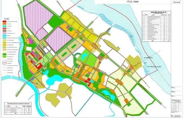
Regulations on cadastral map symbols in Vietnam from January 15, 2025
From January 15, 2025, the regulations on cadastral map symbols in Vietnam will be applied according to Circular 26/2024/TT-BTNMT.

Regulations on cadastral map symbols in Vietnam from January 15, 2025 (Image from the Internet)
On November 26, 2024, the Minister of Natural Resources and Environment of Vietnam issued Circular 26/2024/TT-BTNMT which regulates techniques for surveying and establishing cadastral maps.
Regulations on cadastral map symbols in Vietnam from January 15, 2025
Article 20 of Circular 26/2024/TT-BTNMT regulates the symbols for cadastral maps effective in Vietnam from January 15, 2025, as follows:
(1) Elements of the content on cadastral maps and extracted pieces of cadastral maps are represented by symbols as prescribed.
The cadastral map symbols specified in Appendix No. 22 attached to Circular 26/2024/TT-BTNMT are commonly used to represent elements of content on cadastral maps, extracted pieces of cadastral maps at various scales; special cases applied specifically to digital maps or paper maps or a kind of map content or map scale shall follow separate regulations within the symbols and symbol explanations.
(2) Cadastral map symbols comprise scale-drawn symbols, half-scale drawn symbols, and non-scale symbols, among which:
- When using scale-drawn symbols, they are drawn true to the shape and size of the geographical features according to the map scale;
- When using half-scale drawn symbols, one dimension is drawn to scale with the actual size of the geographical feature, while the other is drawn by convention, not to map scale;
- When using non-scale symbols, symbols are drawn by convention without drawing to the size scale of the geographical feature; this symbol is used when geographical features cannot be drawn to map scale and when geographical features drawn to map scale need to be supplemented to enhance the map's readability and orientation capability.
(3) When representing symbols on the map, the center of geometric shapes such as circles, squares, triangles, rectangles, or other geometries that represent the symbols is arranged to coincide with the center of the map object.
In cases where the symbol is a pictorial representation with a base in a geometric shape, the center of the geometry below the symbol's base is the center of the map object symbol; for symbols with a pictorial base in a baseline form, the midpoint of the baseline is the center of the map object.
(4) Map annotations comprise denominal annotations and explanatory annotations. Denominal annotations are used to represent place names and proper names of map objects; explanatory annotations are used to represent attribute information of geographic features on the map.
Annotations are expressed in Vietnamese; when a place name is in a minority language that requires annotation, it is transliterated into Vietnamese. Annotations are displayed on the cadastral map parallel to the southward frame of the map piece; linear-geographic feature annotations and narrow parcel annotations follow the direction of the linear shape and parcel shape, with lettering and numerals oriented northward.
(5) When representing houses and constructions located entirely within a parcel boundary, priority is given to displaying complete information about the parcel.
For constructions in small and dense areas with historical, cultural, and directional significance, it is permissible to select more representative constructions to display, ensuring no content overlap on the map.
For map objects with representative directional significance where annotations cannot be placed inside the object, annotations are placed outside with an arrow pointing to the object for identification.
More details can be found in Circular 26/2024/TT-BTNMT effective from January 15, 2025.
- Key word:
- cadastral map
- Vietnam
- Number of deputy directors of departments in Vietnam in accordance with Decree 45/2025/ND-CP
- Cases ineligible for pardon in Vietnam in 2025
- Decree 50/2025 amending Decree 151/2017 on the management of public assets in Vietnam
- Circular 07/2025 amending Circular 02/2022 on the Law on Environmental Protection in Vietnam
- Adjustment to the organizational structure of the Ministry of Health of Vietnam: Certain agencies are no longer listed in the organizational structure
- Vietnam aims to welcome 22-23 million international tourists in Vietnam in 2025
-

- Number of deputy directors of departments in Vietnam ...
- 15:04, 05/03/2025
-

- Cases ineligible for pardon in Vietnam in 2025
- 14:43, 05/03/2025
-

- Decree 50/2025 amending Decree 151/2017 on the ...
- 12:00, 05/03/2025
-

- Circular 07/2025 amending Circular 02/2022 on ...
- 11:30, 05/03/2025
-

- Adjustment to the organizational structure of ...
- 10:34, 05/03/2025
-

- Notable new policies of Vietnam effective as of ...
- 16:26, 11/04/2025
-
.Medium.png)
- Notable documents of Vietnam in the previous week ...
- 16:21, 11/04/2025
-
.Medium.png)
- Notable documents of Vietnam in the previous week ...
- 16:11, 02/04/2025
-
.Medium.png)
- Notable new policies of Vietnam to be effective ...
- 16:04, 02/04/2025
-
.Medium.png)
- Notable new policies of Vietnam effective from ...
- 14:51, 21/03/2025
 (1).png)
 Article table of contents
