Factors for monitoring and investigating saltwater intrusion in Vietnam
Recently, the Ministry of Natural Resources and Environment (BTNMT) has issued Circular 39/2016/TT-BTNMT stipulating technical regulations on monitoring and investigating saltwater intrusion in Vietnam, effective from February 10, 2017.

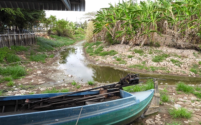
Factors for monitoring and investigating saltwater intrusion in Vietnam - Illustrative image
Article 7 of Circular 39/2016/TT-BTNMT stipulates the factors for monitoring and investigating saltwater intrusion in Vietnam, including:
1. Salinity measurement locations
- The salinity measurement location is determined at the middle of the flow or at the representative hydrological vertical (if the measurement point is at a hydrological station measuring discharge).
- From the chosen measurement location above, measure salinity at three layers:
+ Surface layer (0.2h below the water surface), where h is the depth of the hydrological vertical, calculated in cm;
+ Middle layer (0.5h below the water surface);
+ Bottom layer (0.8h below the water surface);
+ During salinity measurement, proceed sequentially from the surface layer to the bottom layer;
+ In cases where the hydrological vertical depth h ≤ 300 cm, salinity needs to be measured only at the middle layer (0.5h).
2. Monitoring regime
- Measurement period: The measurement is usually conducted during the 6-month dry season. The dry season in different regions varies and tends to become progressively later from North to South (based on Decision 46/QD-TTg dated August 15, 2014, by the Prime Minister of Vietnam on the forecast, warning, and dissemination of natural disaster information). Therefore, the measurement period in different regions also varies. To be specific:
+ For rivers in the North region, from December of the previous year to May of the following year;
+ For rivers in the Central region:
++ From Quang Binh to Quang Ngai, from March to August of the year;
++ From Binh Dinh to Binh Thuan, from February to July of the year.
+ For rivers in the South region, from January to June of the year;
+ For rivers in areas with unusual salinity intrusion activities, surveys can be conducted outside the aforementioned periods.
- Within a month, measure salinity during the characteristic tidal phases for spring and neap tides. The specific measurement time within the month follows the tidal table published annually.
- Measurement regime: The salinity measurement regime is specified as follows:
+ Regime 1: Hourly measurements (0, 1, 2, …… 23 hours). Starting at the lowest water level (rounded to the nearest hour) and continuing for 24 hours.
+ Regime 2: Odd-hour measurements (1, 3, .... 23 hours), starting at the lowest water level (rounded to the nearest hour) and continuing for 24 hours.
+ Regime 3: Measurements according to the peak and trough salinity phases as follows:
+ When the lowest water level appears (rounded to the nearest hour), measure continuously 3 times, with 2-hour intervals between each measurement (e.g., if the lowest water level appears at 7 hours, measure at 7, 9, and 11 hours);
+ When the highest water level appears, continue measuring 4 times continuously, with 1-hour intervals between each measurement (e.g., if the highest water level appears at 1 hour, measure at 1, 2, 3, and 4 hours);
+ Then, measure 3 more times consecutively with 2-hour intervals when the next lowest water level appears.
+ Regime 4: conduct continuous 3-day measurements (72 hours) following the hourly or odd-hour measurement regime (starting at 0 hours or 1 hour).
Detailed regulations may be found in Circular 39/2016/TT-BTNMT issued on December 19, 2016.
Le Vy
- Number of deputy directors of departments in Vietnam in accordance with Decree 45/2025/ND-CP
- Cases ineligible for pardon in Vietnam in 2025
- Decree 50/2025 amending Decree 151/2017 on the management of public assets in Vietnam
- Circular 07/2025 amending Circular 02/2022 on the Law on Environmental Protection in Vietnam
- Adjustment to the organizational structure of the Ministry of Health of Vietnam: Certain agencies are no longer listed in the organizational structure
- Vietnam aims to welcome 22-23 million international tourists in Vietnam in 2025
-

- Number of deputy directors of departments in Vietnam ...
- 15:04, 05/03/2025
-

- Cases ineligible for pardon in Vietnam in 2025
- 14:43, 05/03/2025
-

- Decree 50/2025 amending Decree 151/2017 on the ...
- 12:00, 05/03/2025
-

- Circular 07/2025 amending Circular 02/2022 on ...
- 11:30, 05/03/2025
-

- Adjustment to the organizational structure of ...
- 10:34, 05/03/2025
-

- Notable new policies of Vietnam effective as of ...
- 16:26, 11/04/2025
-
.Medium.png)
- Notable documents of Vietnam in the previous week ...
- 16:21, 11/04/2025
-
.Medium.png)
- Notable documents of Vietnam in the previous week ...
- 16:11, 02/04/2025
-
.Medium.png)
- Notable new policies of Vietnam to be effective ...
- 16:04, 02/04/2025
-
.Medium.png)
- Notable new policies of Vietnam effective from ...
- 14:51, 21/03/2025
 Article table of contents
